About this hike (Purple route)
SELFGUIDED TOUR
DISTANCE: From Igaliku (return) about 30 km. 10–12 hours. Max elevation 1,752 m.
MAP: Arctic Sun. Narsarsuaq (Qassiarsuk – Igaliku) 1:50,000
ORIENTATION/DIFFICULTY: From the plateau there are no marks. Requires good orientation skills and good visibility. Moderate to difficult hiking. Rough to difficult terrain with talus deposits and snow.
ACCOMMODATION: Igaliku Country Hotel in Igaliku. Possibility of camping out in a tent on the plateau, which reduces the walk by about 16 km and 4–5 hours.
ROUTE DESCRIPTION
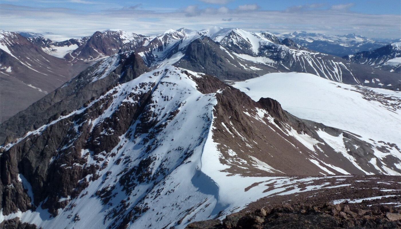
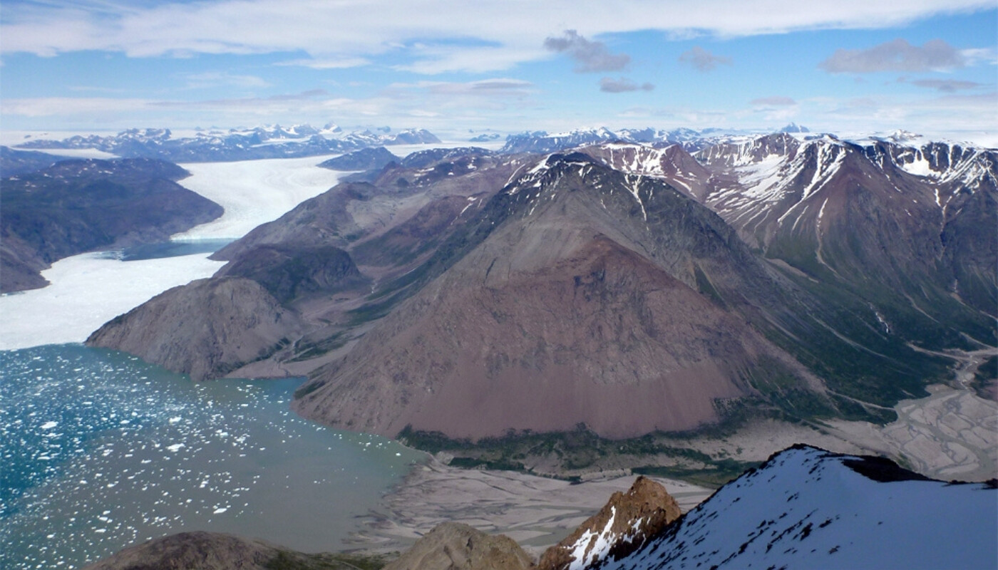
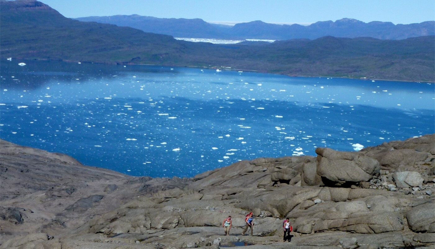
Illerfissalik (Burfjeld) Mountain is the landmark of the entire region. It is a summit you want to climb from the very first moment you see it, and your eyes are constantly drawn towards it when you sail by on the fjord below.
The Norsemen called it Burfjeld and legend has it that they maintained a look-out on the summit. When ships arrived from the south, they would light bonfires to signal to all residents of the area that now was the time to gather to trade goods and exchange news.
At 1,752 metres, the summit is the highest peak in the area. It does not require climbing skills or equipment to climb it, but it’s not a trip for beginners!
From Igaliku you follow the route to the plateau:
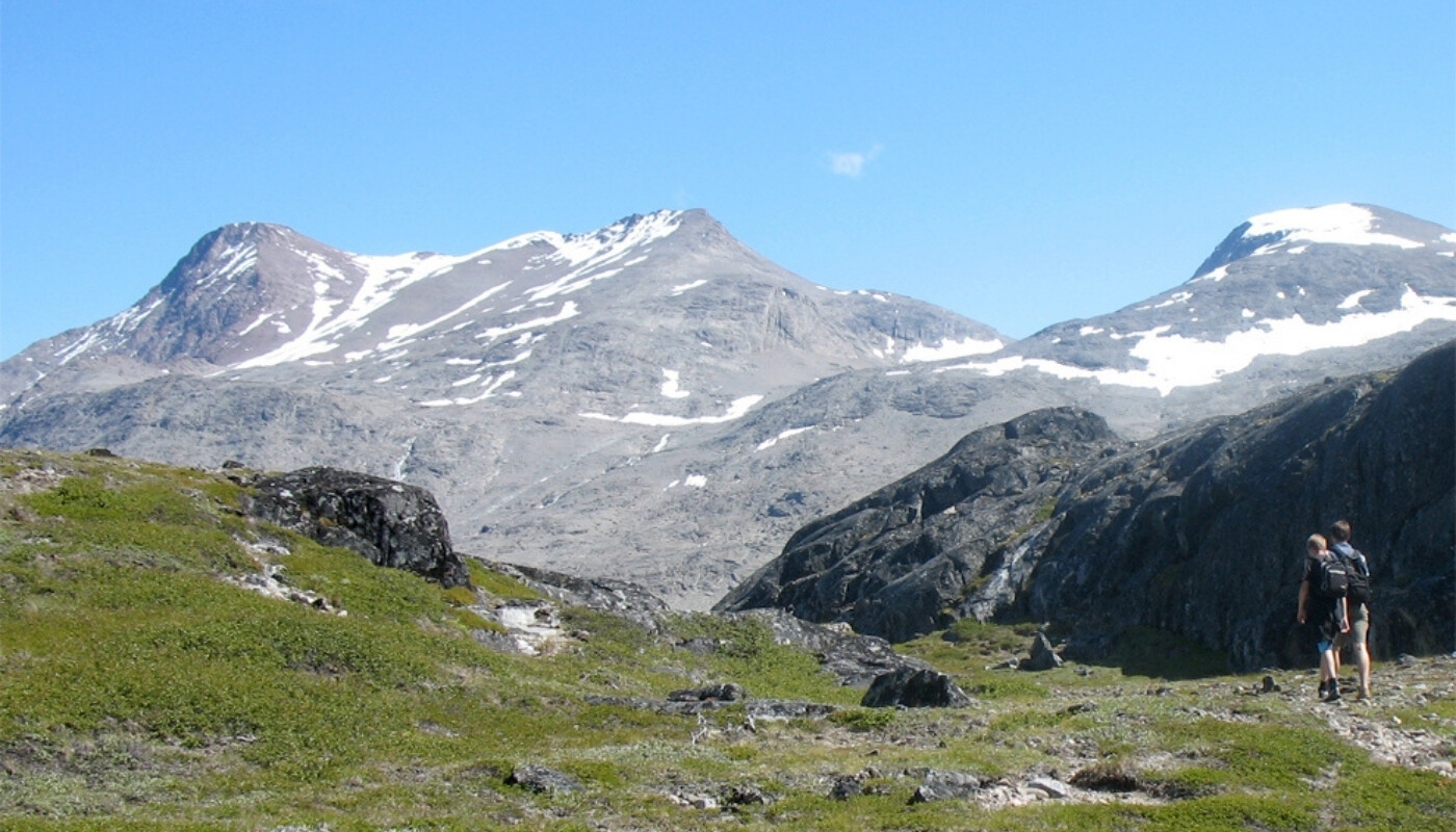
- From the vantage point (the signpost) on the plateau, you aim directly for the top. The first few kilometres are quite easy in slightly undulating terrain.
- Then you have to find the best spot to cross the stream that runs down the gorge at Blue Ice Camp. This can vary according to the season and the quantity of water flowing down from above. After crossing it, you continue towards the summit.
- The terrain now consists of talus and loose rocks, so keep your eyes open for solid rock to step on, otherwise it quickly becomes one step up and two steps down!
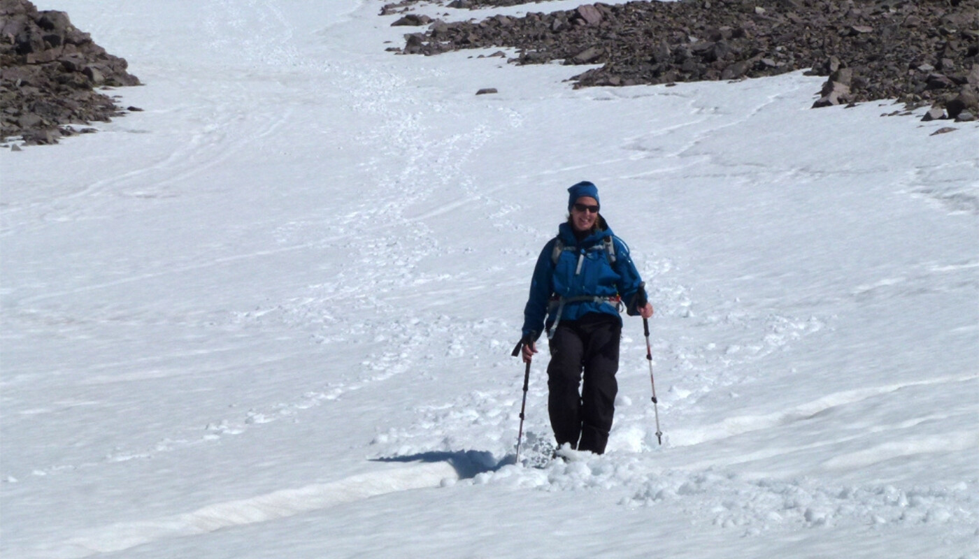
- We recommend that you aim for the lower part of the snowfield that remains between the mountain’s two peaks all summer, then zigzag on the snow to the top.
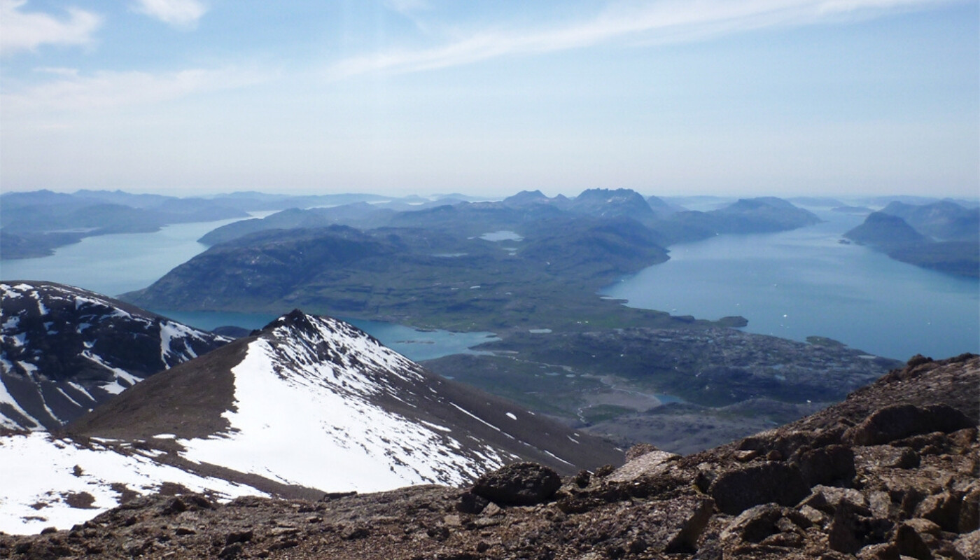
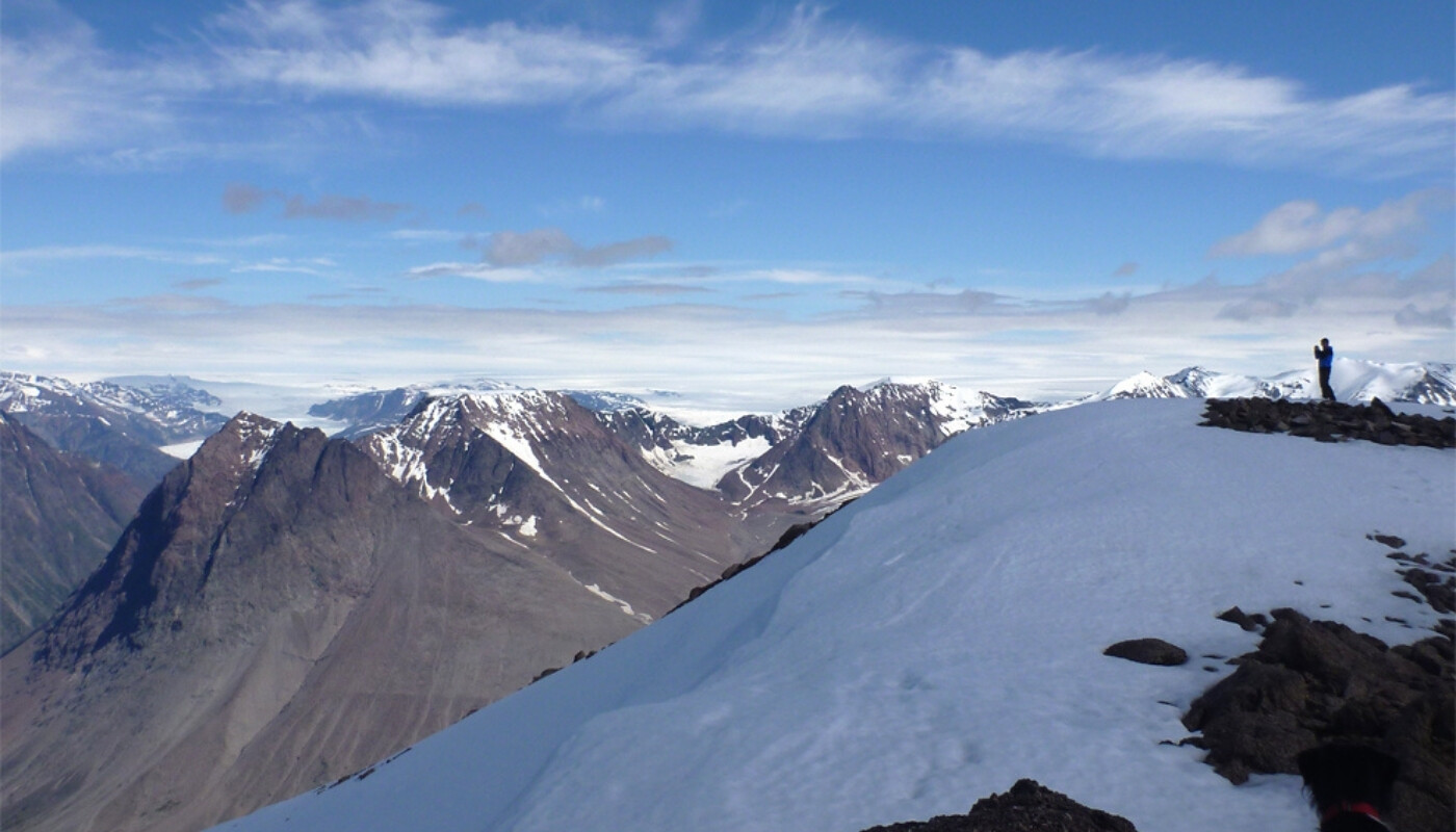
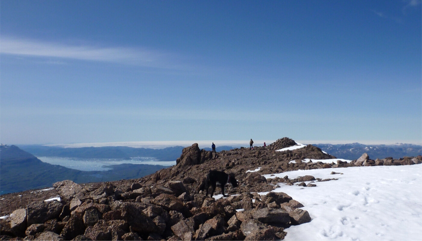
- The last stretch consists of large boulders and rocks. The view is of course absolutely jaw-dropping and on a clear day you can see most of South Greenland!
Travel packages to South Greenland
Tour Description
Discover South Greenland through Norse history, unique landscapes and Arctic farming traditions.
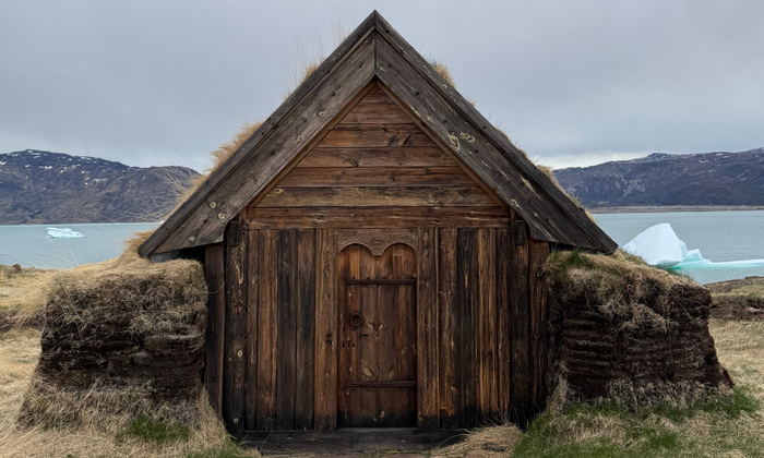
Visit the ancient Norse settlements of Hvalsey, Igaliku and Qassiarsuk – UNESCO World Heritage sites that reveal the story of early settlers who shaped life and farming culture in Greenland, still alive today through modern Greenlandic sheep farming.
In Qaqortoq, explore the colourful town where everyday life unfolds surrounded by fjords and mountains.
The journey also includes a breathtaking boat trip into the Qooroq Ice Fjord, where turquoise icebergs drift in silence beneath the glacier.
.png)
Trip Highlights
- Explore three UNESCO World Heritage Sites in South Greenland
- Walk in the footsteps of early settlers in remote Norse settlements
- Spend 2 nights in charming Igaliku Country Lodge
- Hike through dramatic valleys and mountain landscapes
- Sail through the Qooroq Ice Fjord and enjoy a drink chilled with glacier ice
- Discover everyday Greenlandic life in the colorful town of Qaqortoq
Price Includes
The price estimate is based on the inclusion of the elements listed below. The final travel itinerary will be prepared in collaboration with our travel advisor, who will create a travel offer based on this.
Accommodations
- All accommodation incl. breakfast*
- 2 night in Igaliku Country Hotel
- 1 night in Narsarsuaq
- 1 night in Hotel Qaqortoq
Meals
- 4 x Breakfast at the accommodations
Excursions and Transportation
- Transport of luggage in Igaliku and Qaqortoq
- All boat transfers
- Boat trip to the Qooroq Ice Fjord
- Boat trip to Hvalsey Church
- Airport transfers in Qaqortoq
Other
- Tourist tax
Price excludes
- Flights
- Pocket money and expenses for beverages
- Other meals than those listed under “Price Includes”
- Other excursions than those listed under “Price Includes”
- Tour guide (this trip is self-guided)
- Travel and/or cancellation insurance
- Single room supplement, Aprox EUR 1.338 per person
Travel safely to Greenland with Topas – we are with you every step of the way
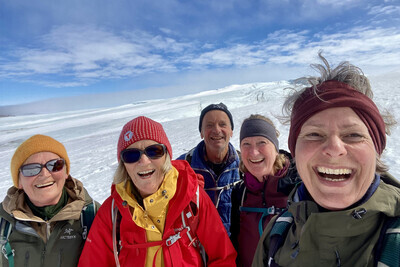
When you choose to travel with Greenland by Topas, you choose more than just transportation and accommodation. You choose a complete travel experience, where nature, culture, and personal guidance go hand in hand—before, during, and after your journey.
This is why many choose us:
Tailor-made journeys – with you at the center
We arrange package tours without a tour leader, but with a high degree of security and guidance. You travel independently, but you are never left on your own.
Experienced Greenland specialists
Our advisor, Line Vinterberg, who has led Topas group tours in Greenland, knows the country intimately and is ready to help you tailor your journey—whether you dream of Disko Bay, Narsarsuaq, or something entirely different.
Personal guidance – every step of the way
We assist you with planning, booking, and practical details, so you can focus on what matters most: your experiences in Greenland. You receive a well-prepared itinerary and access to experienced local partners along the way.
Local knowledge and strong partnerships
Topas has been organizing trips to Greenland since 1998 and today works closely with, among others, Disko Line, Blue Ice Explorer, and several hotels in Disko Bay—giving you access to the best experiences and facilities.
Safety and responsibility
Topas is a member of the Danish Travel Agency Association and part of the Travel Guarantee Fund. In addition, we are affiliated with the UN Global Compact and actively work with responsible tourism and sustainable values.
Your Itinerary
The day-by-day travel program below is a recommended itinerary combining the UNESCO-sites in Greenland over 5 days / 4 nights.
The program is indicative and can be customized according to your choice of activities and hotels. The price indication is a guideline for the proposed trip and may vary depending on the season and your preferences. Upon inquiry, a specific travel offer will be prepared.
Please note! Due to limited capacity at some overnight accommodations, the order of the itinerary may change.
Day 1. First taste of South Greenland
Arrive in Qaqortoq Airport (JJU)
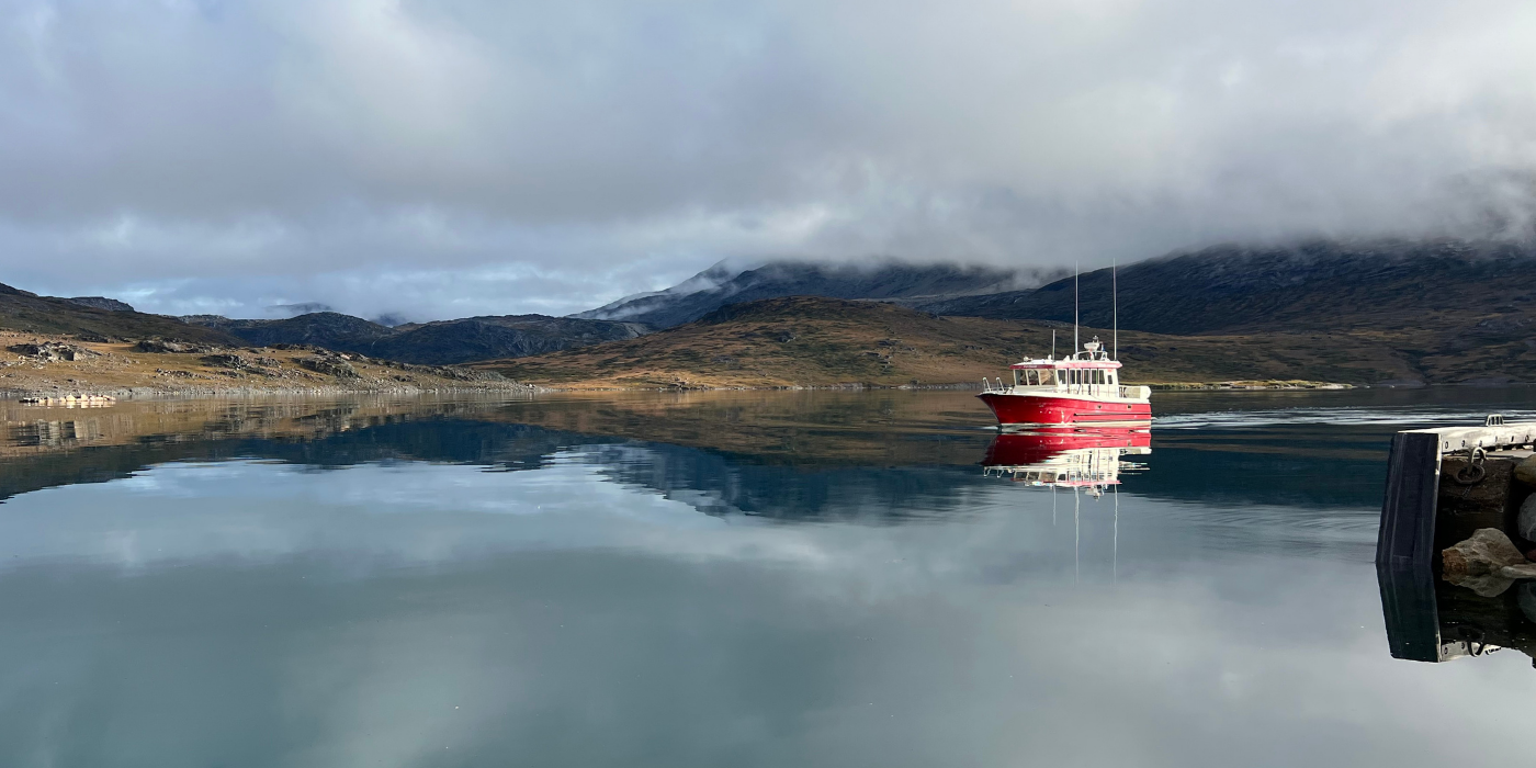
- Arrive in Qaqortoq, the capital of South Greenland, where our staff welcomes you and helps you get started on your journey.
- Sail through the scenic fjords towards Igaliku, one of Greenland's most charming settlements.
- Check in at Igaliku Country Hotel and spend the rest of the day exploring the village, enjoying the fjord views and settling into the slower pace of life in South Greenland.
.png)
Included Hotel (Day 1)
Igaliku Bygdehotel
In the heart of the historic settlement of Igaliku, you will find Igaliku Bygdehotel, where Greenlandic hospitality meets scenic surroundings. The hotel is surrounded by lush valleys and fjords, making it an ideal base for exploring the area’s Viking history, impressive hiking trails, and relaxing atmosphere.
Day 2. Norse ruins and spectacular hiking trails
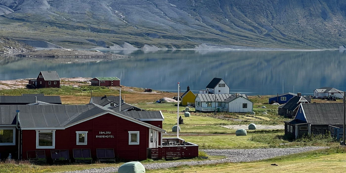
- Wake up in Igaliku, one of Greenland's most beautiful settlements. Colourful houses sit on lush green hills beside a milky-blue fjord, while the iconic Illerfissalik (Burfjeld) Mountain rises dramatically on the opposite shore.
- Spend the day exploring at your own pace. Wander among the impressive Norse ruins of Gardar, once the religious centre of Viking Greenland, or simply enjoy the peaceful atmosphere that makes Igaliku so special.
- For those who want to venture further, some of South Greenland's finest hiking trails begin right outside the village.
Optional selfguided hiking tours (Day 2)
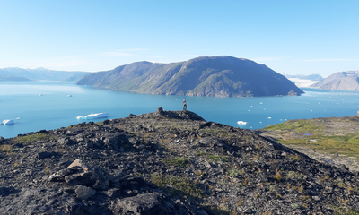
The Plateau Hike (17 km)
Hike to a spectacular viewpoint overlooking the Qooroq Ice Fjord, where stranded icebergs and a vast glacier create one of South Greenland's most impressive panoramas. On the way back, keep an eye out for minerals and stones, including the shimmering "moon stone" (labradorite).

The Waterfall Hike (15 km)
Follow a scenic trail to a series of beautiful waterfalls cascading towards Tunulliarfik Fjord. This is one of the most popular hikes in the area. Along the way, you’ll enjoy fantastic views of the blue fjord, often with icebergs drifting by.
.jpg)
Nuuluk Mountain Summit (823 m)
For experienced hikers, the ascent of Nuuluk Mountain offers sweeping views of fjords, mountains and farmland. The summit can be combined with the Waterfall Hike, creating a challenging day hike of 20–22 km.
_(2).png)
Included Hotel (Day 2)
Igaliku Bygdehotel
In the heart of the historic settlement of Igaliku, you will find Igaliku Bygdehotel, where Greenlandic hospitality meets scenic surroundings. The hotel is surrounded by lush valleys and fjords, making it an ideal base for exploring the area’s Viking history, impressive hiking trails, and relaxing atmosphere.
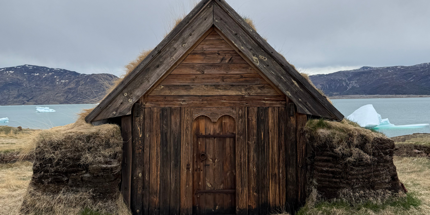
Day 3. Icebergs and Viking history
- Start the day with a scenic hike along the King's Road from Igaliku to Itilleq (4 km), following a historic route through South Greenland's stunning landscapes.
- From Itilleq, board a boat and sail among icebergs of all colours, sizes and shapes in the spectacular Qooroq Ice Fjord. As the glacier comes into view, the engine is switched off, allowing you to enjoy the absolute silence of the Arctic and a drink chilled with glacier ice more than 1,000 years old.
- Continue to Qassiarsuk, better known as Brattahlid, where Erik the Red settled in AD 982. Explore the well-preserved Norse ruins and discover the story of the Vikings who once called Greenland home. You can also visit the open-air museum (admission fee not included).
- In the afternoon, continue to Narsarsuaq, where you will spend the night.
.png)
Activity on Day 3 (Included)
Boat Trip to Qooroq Ice Fjord
On the boat trip, we cross the underwater moraine at the mouth of Qooroq Fjord. Many of the large icebergs run aground here, and we sail closely past them to get through and into the fjord. A sight and experience of truly epic proportions.
.png)
Activity on Day 3 (Included)
Qassiarsuk (Brattahlid)
Today, sheep farmers work the very same lands that Erik the Red and his people settled over 1,000 years ago. Take a walk through the settlement, where you can feel the atmosphere of a small South Greenlandic community, while also seeing how the history of the Norse settlers and modern sheep farming come together.Read more about the activity.
Included hotel (Day 3)
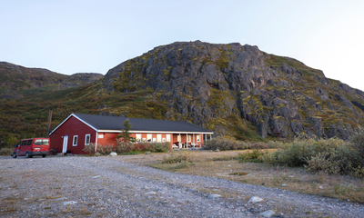
Narsarsuaq Hostel
The hostel is nestled at the foot of a mountain with a view of the fjord. In the summertime there is always a pleasant atmosphere, with hikers and travellers exchanging experiences and planning tours.
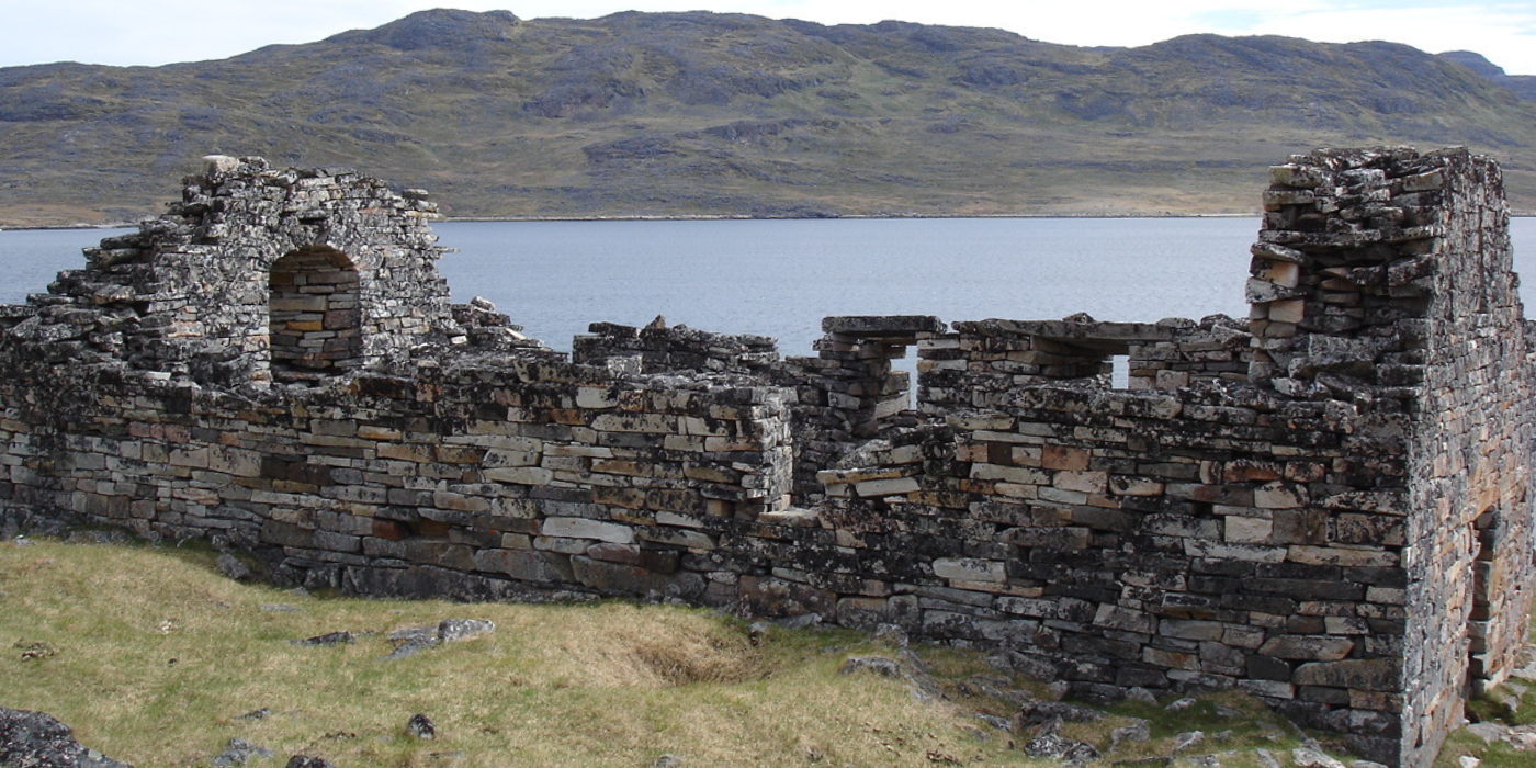
Day 4. Art, culture and Norse heritage
- Start the day with a scenic boat journey from Narsarsuaq to Qaqortoq, the largest town in South Greenland (about 3,300 inhabitants). As you approach, colourful houses appear along the hillsides, marking your return to one of the region’s cultural centres.
- Spend the afternoon exploring Qaqortoq at your own pace. Wander through the town’s unique open-air art project “Stone and Man”, where more than 30 sculptures are carved directly into the granite bedrock.
- Discover local life around the harbour and the nearby fish market, where fishermen sell their catch of the day, and take in the atmosphere of the town square with Greenland’s oldest fountain.
- Later, continue to the Hvalsey Church UNESCO site, one of the best-preserved medieval ruins in South Greenland. With walls up to 6 metres high, it offers a powerful glimpse into the country’s Viking history.
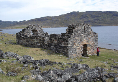
Activity on Day 4 (Included)
Hvalsey Church Ruins
The largest, most famous, and best-preserved ruin in Greenland. Now also part of the UNESCO World Heritage area in South Greenland. Only half an hour by boat from Qaqortoq, up the Qaqortoq Fjord, sheltered from the open sea and beautifully surrounded by high mountains and green fields.Read more about the activity.
_(2).png)
Included Hotel (Day 4)
Hotel Qaqortoq
★ ★ ★ ★The phrase “Home – away from home” is not just a slogan but a central guiding principle for Hotel Qaqortoq and its staff. This 4-star hotel enjoys one of the town’s best locations, with views over the harbor and town center, making it a natural gathering place for both guests and locals.
Read more about the hotel.
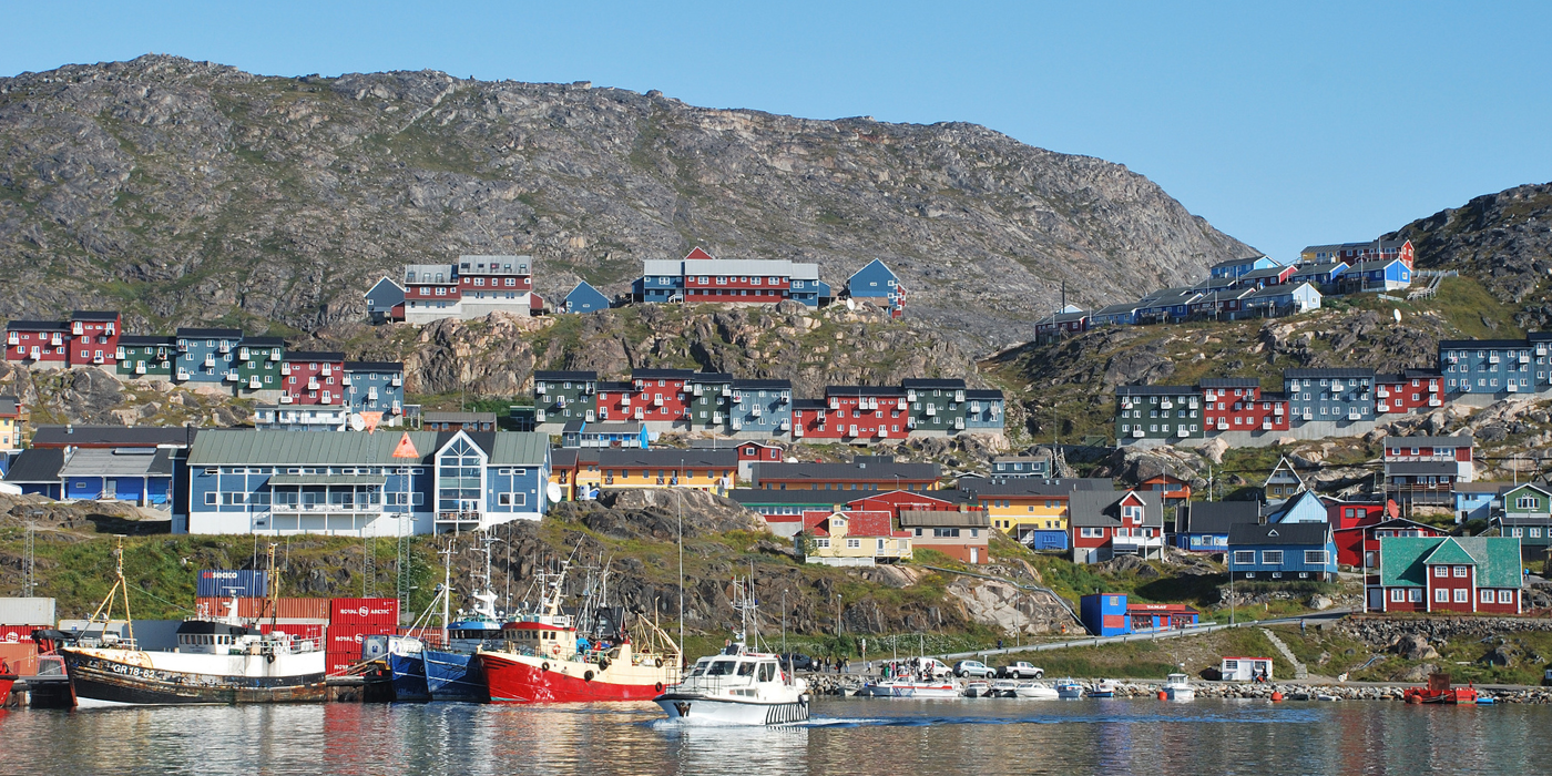
Day 5. Farewell to South Greenland
Depart from Qaqortoq Airport (JJU)
Enjoy a final glimpse of South Greenland’s fjords and colourful townscape before your journey home.
At the arranged time, you will be picked up and driven to the airport for your departure, taking with you memories of fjords, icebergs, Viking history and life in one of the world’s most remote landscapes.
Meals: Breakfast
Extend Your Trip?
Do you feel the trip is too short and want to extend it? Whether it’s to another destination in Greenland or simply more time to explore, feel free to ask us. We have extensive knowledge of Greenland and can provide guidance quickly and easily.
Season and practical info
Greenland is a truly unique destination – majestic, yet not always easy to reach. That is part of its charm. Our travel advisors are happy to help you tailor a trip that matches your wishes and interests. As part of our guidance, we also advise you on the best time to plan your journey, ensuring you bring home the most memorable experiences.
About South Greenland and this itinerary
In 2017 five core areas in South Greenland were inscribed in the UNESCO World Heritage List. They represent a unique landscape and arctic farming history, dating from the Norse settlement to the present day Greenlandic sheep farmers. On this tour, you can visit Hvalsey, Igaliku and Qassiarsuk – 3 of the UNESCO sites – together with South Greenland’s colourful town Qaqortoq. In addition we will take you on an unforgettable boat ride into the Qooroq Ice Fjord.
When is the best time to travel?
You can start this tour every day of the week and are free to choose your own pace and what to see and do each day. Just let us know which date/flight you will arrive with and we will book the tour for you as desired.
The best time to travel for this itinerary in South Greenland is from June to September.
Difficulty
No special requirements on this trip. The hike between Itilleq and Igaliku is 4 km.
Self-guided
All our package tours are self-guided. This means that you are not a part of a bigger group with a tour leader to guide you around. We will send you very detailed information about the tour before you arrive in Greenland.
Accommodation and meals
Accommodation at hotel and guest house with private or shared facilities. Breakfast is included.
Dinner and lunch packets can be ordered at the hotels in Qaqortoq and Igaliku. In Narsarsuaq there is a large kitchen available for preparing your own meals. Alternatively, you can buy a ready prepared meal on site.
(*) All rooms in Narsarsuaq are with shared toilet facilities.
How to get here
There are direct flights to Qaqortoq (South Greenland) from Nuuk (GOH) all year round and from Iceland (Reykjavik, KEF) in the high season from mid-June to early September.
Tickets can be purchased at the airlines’ websites:
- Air Greenland flies from Nuuk to Qaqortoq.
- Icelandair flies from Reykjavik to Qaqortoq. Iceland air provides connecting flights from many major cities in US and EU. With just one stopover in Reykjavik.
Several airlines fly from Europe and the US to Denmark and Iceland.
Please notice, flight tickets are not included in any of our tours or products.
Food and drink
Meat and fish are the foundation of the Greenlandic diet, so be prepared for high-protein fare with relatively few vegetables and side dishes.
In South Greenland you will primarily be served lamb, but also musk ox, reindeer and whale meat. Cod, trout and shrimp are the most common fish and seafood used in South Greenlandic cuisine.
If you have an opportunity to cook your own meals, you won’t want to miss out on a visit to the local meat and fish market, where hunters and fishermen sell the catch of the day.
In South Greenland several sheep farmers have also begun to grow potatoes, turnips, lettuce and cabbage on a larger scale and you can enjoy this fresh produce if you are travelling in late summer.
Opening hours
There are grocery stores (the Pilersuisoq chain) in the villages of Narsarsuaq, Qassiarsuk and Igaliku, where you can buy canned, dried and frozen food, and to a limited extend fresh products. If your package tour includes one of the major towns, we always recommend that you buy food in a supermarket there before continuing on to a small village.
In the towns of Narsaq, Qaqortoq and Nanortalik shops are generally open from 8-9 am to 5-6 pm on weekdays, with slightly shorter opening hours on Saturdays and Sundays. In the settlements (Narsarsuaq, Qassiarsuk and Igaliku) shop opening hours are somewhat more limited: weekdays often from 10 am to 3 pm, Saturdays 10-12 am and closed on Sundays.
About dining in villages and on sheep farms
We always recommend that you take the opportunity to eat locally and taste different Greenlandic dishes when you visit a sheep farm or a small settlement. However, please do not expect a large variety of dishes (à la carte menu), as well as a special children’s menu or vegetarian dishes at such places, as shopping facilities and the choice of products are limited.
If you are a vegetarian or have a food allergy (e.g., allergic to gluten), you may want to consider bringing some food along with you, unless you will be staying in the vicinity of a supermarket in one of the major towns!
Costs
The price level of food in shops is roughly the same as in the rest of Northern Europe. Fresh fruit and vegetables, alcoholic drinks and sweets are the most expensive. See below for indicative prices for meals in cafes/restaurants:
Lunch at cafes/hotels: DKK 120-150 (approx. 16-20 EUR)
Dinner at cafeteria / sheep farm / restaurant: DKK 120 (approx. 16 EUR) / DKK 200-300 (approx. 27-40 EUR) / DKK 200-400 (approx. 27-54 EUR)
These prices are without drinks
1 beer at a bar/restaurant: from DKK 50 (approx. 7 EUR)
1 bottle of wine at a restaurant: from DKK 230 (approx. 31 EUR)
Money, Tele & Internet
Currency and Credit cards
The currency used in Greenland is the Danish krone (DKK). You can pay by credit card in stores (also in the settlements), at hotels, restaurants (including the Igaliku Country Hotel) and at tourist offices. However, it is a good idea to have a small amount of cash with you, especially if you are going to stay and dine on a sheep farm, where cash is the only means of payment. There are ATMs in the towns of Narsaq, Qaqortoq and Nanortalik.
Telephony
There is mobile coverage in all towns and villages. Most European telecommunications providers have roaming agreements with Tele Greenland, but it might be quite expensive to use your phone in Greenland. You should also not rely on your mobile phone as a means of communicating with the outside world on a hiking trip, as there are many places in the countryside/mountains where you will not have a signal. If you are planning a longer hiking or kayaking trip in isolated areas, for safety reasons we recommend that you rent a satellite phone.
Internet
There is wireless internet at most hotels and hostels in the towns (including Narsarsuaq and the Igaliku Country Hotel). At most tourist offices you can also borrow a computer to check your emails and so on. What all of these points of access have in common is that you pay for the use of the internet in Greenland and – compared to the rest of Europe – it is quite expensive.
Mobile Phone
Using mobile data from an international phone can be very expensive in Greenland. Make sure to check what your plan covers before enabling data roaming. If you need a Greenlandic SIM card, we recommend Tusass eSIM packages. See prices and packages here (affiliate link).
Access to Electricity
It is possible to charge your devices at the accommodations (bring your own charger).
IMPORTANT NOTE!
Please note that the price of the trip is a starting price, as there may be additional costs for a more expensive type of flight ticket or a different cabin/room standard, depending on availability at the time of booking. You are, of course, only committed to the trip once any price supplements have been confirmed. The starting price is indicated for Greenland’s low season.
Right to Changes Reserved. Please note that a trip like this is weather-dependent, and some changes to the program may occur. Delays and cancellations are possible, especially for flights and boat transport.
No compensation or reimbursement is provided for the first 24 hours of delays or changes due to external circumstances. We will make every effort to minimize inconvenience, provide an alternative program, or make the most of the extra waiting time.
What to bring
For our package tours in South Greenland we recommend:
- A sleeping bag and towel (only if you stay in hostels)
- Slippers or sandals (for use indoors when you stay at hostels/farms or visit a Greenlandic home)
- Hiking boots or solid walking shoes
- Wind and waterproof outerwear
- Sweater or fleece for insulation
- T-shirts and long-sleeved blouses (it can get really hot in the sun on land)
- A knit hat and gloves (it can be rather chilly on a boat trip to the ice fjord)
- A mosquito net and mosquito repellent. The mosquitoes are worst in June and early July in southern Greenland. There may be small, annoying flies in August. Mosquitoes are virtually non-existent in sheep farming areas, but can be troublesome in Narsarsuaq and mountain areas with few or no sheep
- Sunglasses and sun lotion
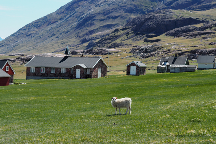
Tour Description
South Greenland is the only region in Greenland where agriculture exists, with more than 30 sheep farms scattered across remote and dramatic landscapes. Here, green pastures, mountains, and fjords form the backdrop for traditional farm life, where sheep, cattle, and horses roam freely.
On this journey, you are invited to visit selected farms and gain a first-hand insight into the daily life of Greenlandic farmers living in close connection with nature.
Over the course of one week, you stay at three different sheep farms and visit small settlements as you hike from place to place along gravel roads and quiet trails. Your luggage is transported between accommodations, allowing you to focus on the hiking experience with just a light daypack.
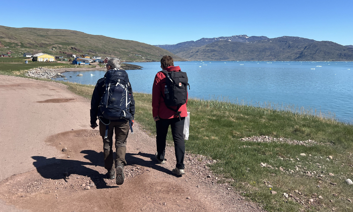
Trip Highlights
- Stay at authentic, working sheep farms in remote South Greenland
- Hike from farm to farm through dramatic mountain landscapes and stunning fjords
- Experience true “alone in the wild” hiking sections far from modern roads and settlements
- Explore the iconic Qooroq Ice Fjord with drifting icebergs and impressive glacier views
- Enjoy the slow pace of life in the picturesque village of Igaliku
Price Includes
The price estimate is based on the inclusion of the elements listed below. The final travel itinerary will be prepared in collaboration with our travel advisor, who will create a travel offer based on this.
Accommodations
- All accommodation incl. breakfast*
- 1 night in Hotel Qaqortoq
- 1 night in Narsarsuaq
- 1 night in Qorlortup farm
- 1 night in Sermilik farm
- 1 night in Sillisit farm
- 2 night in Igaliku Country Hotel
* Please note: All included accommodation at guest houses (private room at hotels and farms with shared toilet facilities). Read more here.
Meals
- 7x Breakfast at the accommodations
Excursions and Transportation
- Transport of luggage
- All boat transfers
- Boat trip to the Qooroq Ice Fjord
- Airport transfers in Qaqortoq
Other
- Tourist tax
Price excludes
- Flights
- Prebooked meals at sheep farms
- Pocket money and expenses for beverages
- Other meals than those listed under “Price Includes”
- Other excursions than those listed under “Price Includes”
- Tour guide (this trip is self-guided)
- Travel and/or cancellation insurance
- Single room supplement, Aprox EUR 1.338 per person
Travel safely to Greenland with Topas – we are with you every step of the way
.jpg)
When you choose to travel with Greenland by Topas, you choose more than just transportation and accommodation. You choose a complete travel experience, where nature, culture, and personal guidance go hand in hand—before, during, and after your journey.
This is why many choose us:
Tailor-made journeys – with you at the center
We arrange package tours without a tour leader, but with a high degree of security and guidance. You travel independently, but you are never left on your own.
Experienced Greenland specialists
Our advisor, Line Vinterberg, who has led Topas group tours in Greenland, knows the country intimately and is ready to help you tailor your journey—whether you dream of Disko Bay, Narsarsuaq, or something entirely different.
Personal guidance – every step of the way
We assist you with planning, booking, and practical details, so you can focus on what matters most: your experiences in Greenland. You receive a well-prepared itinerary and access to experienced local partners along the way.
Local knowledge and strong partnerships
Topas has been organizing trips to Greenland since 1998 and today works closely with, among others, Disko Line, Blue Ice Explorer, and several hotels in Disko Bay—giving you access to the best experiences and facilities.
Safety and responsibility
Topas is a member of the Danish Travel Agency Association and part of the Travel Guarantee Fund. In addition, we are affiliated with the UN Global Compact and actively work with responsible tourism and sustainable values.
Your Itinerary
The day-by-day travel program below is a recommended itinerary combining the Farm Holiday with a hiking round trip over 8 days / 7 nights.
The program is indicative and can be customized according to your choice of activities and hotels. The price indication is a guideline for the proposed trip and may vary depending on the season and your preferences. Upon inquiry, a specific travel offer will be prepared.
Please note! Due to limited capacity at some overnight accommodations, the order of the itinerary may change.
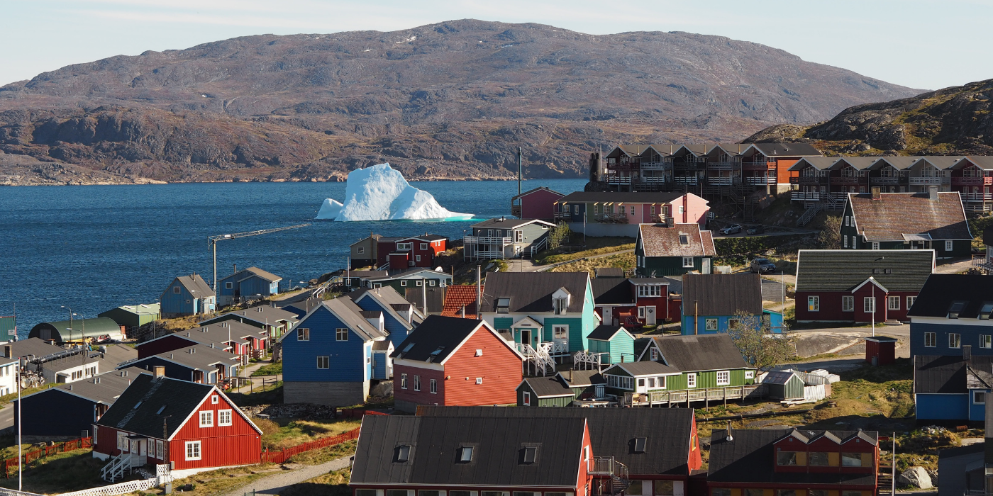
Day 1. Welcome to South Greenland
Arrive at Qaqortoq Airport (JJU)
Today you arrive in South Greenland, and the day is spend on your own pace in the regions largest town, Qaqortoq.
Today's highligts:
-
A short transfer brings you to Qaqortoq (10 km), the largest town in South Greenland and the starting point of your journey.
-
Spend the rest of the day at your own pace. Explore the colourful streets and lively harbour, or discover the famous Stone & Man project, where more than 30 sculptures are carved directly into the granite bedrock and scattered throughout the town.
-
You may also visit the town square with Greenland’s oldest fountain and enjoy the atmosphere where local fishermen and hunters often sell the day's catch.
_(2).png)
Included Hotel (Day 1)
Hotel Qaqortoq
★ ★ ★ ★The phrase “Home – away from home” is not just a slogan but a central guiding principle for Hotel Qaqortoq and its staff. This 4-star hotel enjoys one of the town’s best locations, with views over the harbor and town center, making it a natural gathering place for both guests and locals.
Read more about the hotel.
Day 2. A Day in Narsarsuaq: Gateway to the Inland Ice
The day begins with a boat transfer from Qaqortoq to Narsarsuaq (approx. 2 hours). Here, you have the rest of the day at leisure to explore the area on your own.
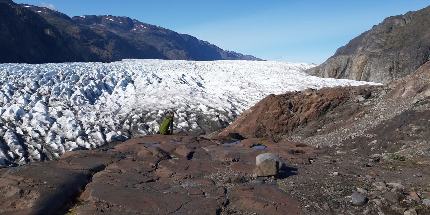
Narsarsuaq offers beautiful hiking opportunities and is the place in Greenland with the shortest hiking distance to the inland ice. Take a look at all the different hiking trails in Narsarsuaq here.
This is also a good opportunity to prepare for the days ahead, stock up on snacks, and get your backpack ready for hiking in more remote areas.Meals: Breakfast
Optional selfguided hiking tours (Day 2)
Signal Hill - Red Route (4 km)
The hike to the top of Signal Hill is a “must” if you stay in Narsarsuaq. It is a short and easy walk of around 1 hour, where you will experience the ice sheet and breathtaking views of the Narsarsuaq area.
The Ridge - Yellow Route (8 km)
If you are looking for a nice, shorter and easier alternative to the full-day tour to Narsarsuaq glacier, the Ridge is for you. The Ridge offers great views, rich flora and fauna (birds, mountain hare) and is also an excellent trip in bad weather (e.g., strong foehn winds)!
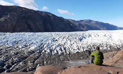
Narsarsuaq Glacier - Blue Route (16 km)
The hike to the ice cap (Narsarsuaq Glacier) is a classic walk from Narsarsuaq. On this day trip you can reach the glacier and touch the ice! Furthermore, it is a trip that will offer you several different types of landscapes. This hikes takes 5-7 hours. The path is easy, but with a steep ascent and descent.
.png)
Included hotel (Day 2)
Narsarsuaq Hostel
The hostel is nestled at the foot of a mountain with a view of the fjord. In the summertime there is always a pleasant atmosphere, with hikers and travellers exchanging experiences and planning tours.
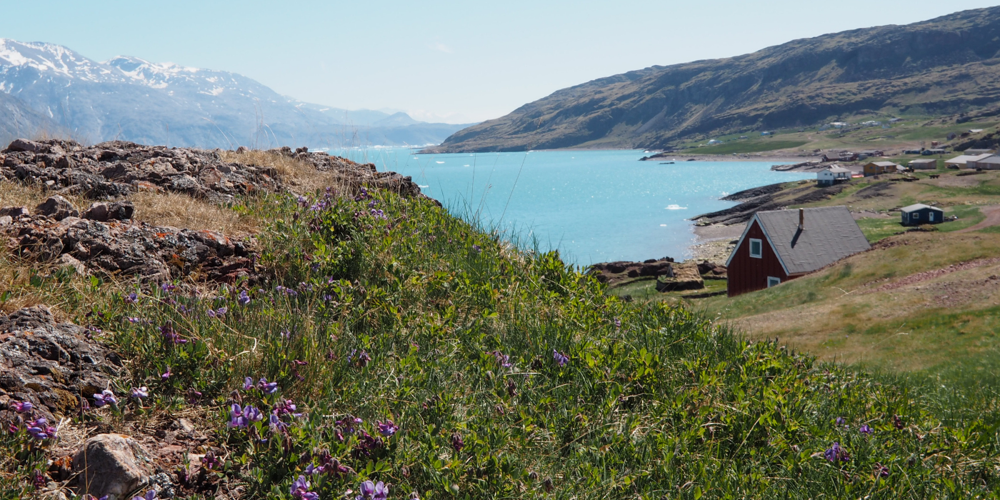
Day 3. Fjordside Hiking from Qassiasuk to Qorlortup Farm (10 km)
With around 40 inhabitants, Qassiarsuk is a small farming community where sheep farming is the main livelihood, alongside a school, a church, and a local shop.
Also known as Brattahlid, this is where Erik the Red established his settlement in 982. Today, the area is home to well-preserved Norse ruins, which you can explore at your own pace. The open-air museum can also be visited (admission fee not included).
Today’s highlights:- From Qassiarsuk, you continue your hike north along a gravel road following the scenic shores of Tunulliarfik Fjord. The route is easy to walk and offers continuous views across the fjord towards Narsarsuaq on the opposite side.
- If you bring a fishing rod, this stretch offers a good opportunity to try your luck in the fjord, especially near the mouth of the Qorlortoq River.
- Before reaching the river, you turn left and follow a gravel road uphill to Qorlortup Ittinnera Farm, your destination for the day.
The total hike today is approximately 10 km.
Meals: Breakfast
Included Accommodation (Day 3)
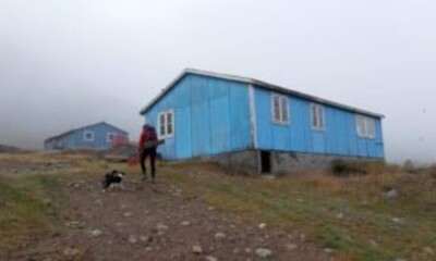
Qorlortup Ittinnera farm
Right before the Qorlortoq river, the gravel road on the left side leads uphill to the Qorlortup Ittinnera farm. The accommodation has a living room and self-service kitchen.
Day 4. Through the Qorlortup Itinnera Valley to Tasiusaq Sheep Farm (10 km)
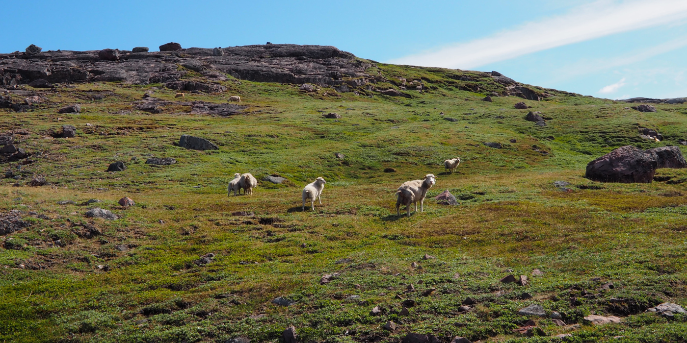
Today’s hike takes you through the beautiful Qorlortup Itinnera valley, heading towards the bay of Tasiusaq in the Sermilik Fjord. There is no marked trail through the valley, but the route is easy to follow as you walk along a small stream leading all the way towards the fjord.
Today’s highlights:
- In many places, you can follow sheep tracks that naturally guide you through the landscape. Looking up, you may be lucky enough to spot white-tailed eagles soaring above the valley.
- As you get closer to the bay of Tasiusaq, gravel roads and paths begin to appear, leading you towards the Tasiusaq sheep farm.
Today’s hike is approximately 10 km
Meals: Breakfast
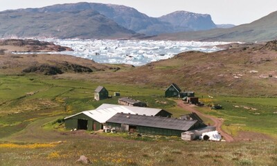
Included Accommodation (Day 4)
Sermilik Hostel – Tasiusaq
Farm accommodation in Tasiusaq. The amount of icebergs here are stunning and you begin to understand why the farmers love this place.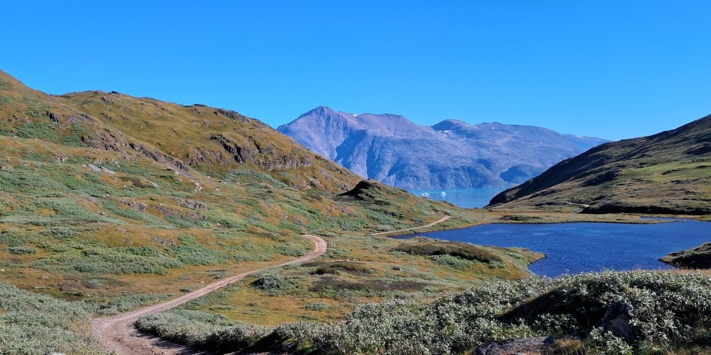
Day 5. Hike from Tasiusaq to Sillisit Along the Sheep Track (15 km)
Today’s hike takes you from Tasiusaq to Sillisit, a long and varied day covering approximately 15 km.
Today’s highlights:
- From Tasiusaq, you begin by following a sheep track along the innermost part of the fjord for the first 3 kilometres. At Nunataaq, you join the gravel road towards Qassiarsuk, before leaving it again after about 1 km to continue across slightly undulating terrain towards Sillisit.
- This section of the route is a true “alone in the wild” experience in South Greenland, and you navigate by following small stone cairns built by farmers and fellow hikers.
- Sillisit is beautifully located opposite the Qooroq Ice Fjord. Here, you find today's farm stay in idyllic settings.
Today’s hike is approximately 15 km. In case of bad weather, it is recommended to stay on the gravel road all the way, passing by the Inneruulalik sheep farm, before reaching Sillisit. This is somewhat longer, approximately 23 km.
Meals: Breakfast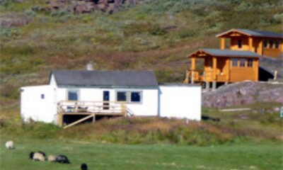
Included Accommodation (Day 5)
Sillisit farm
Farm accommodation in Sillisit. The farm offers an idyllic setting where a stunning wilderness backdrop meets the warm hospitality of a Greenlandic farm family—an unforgettable experience.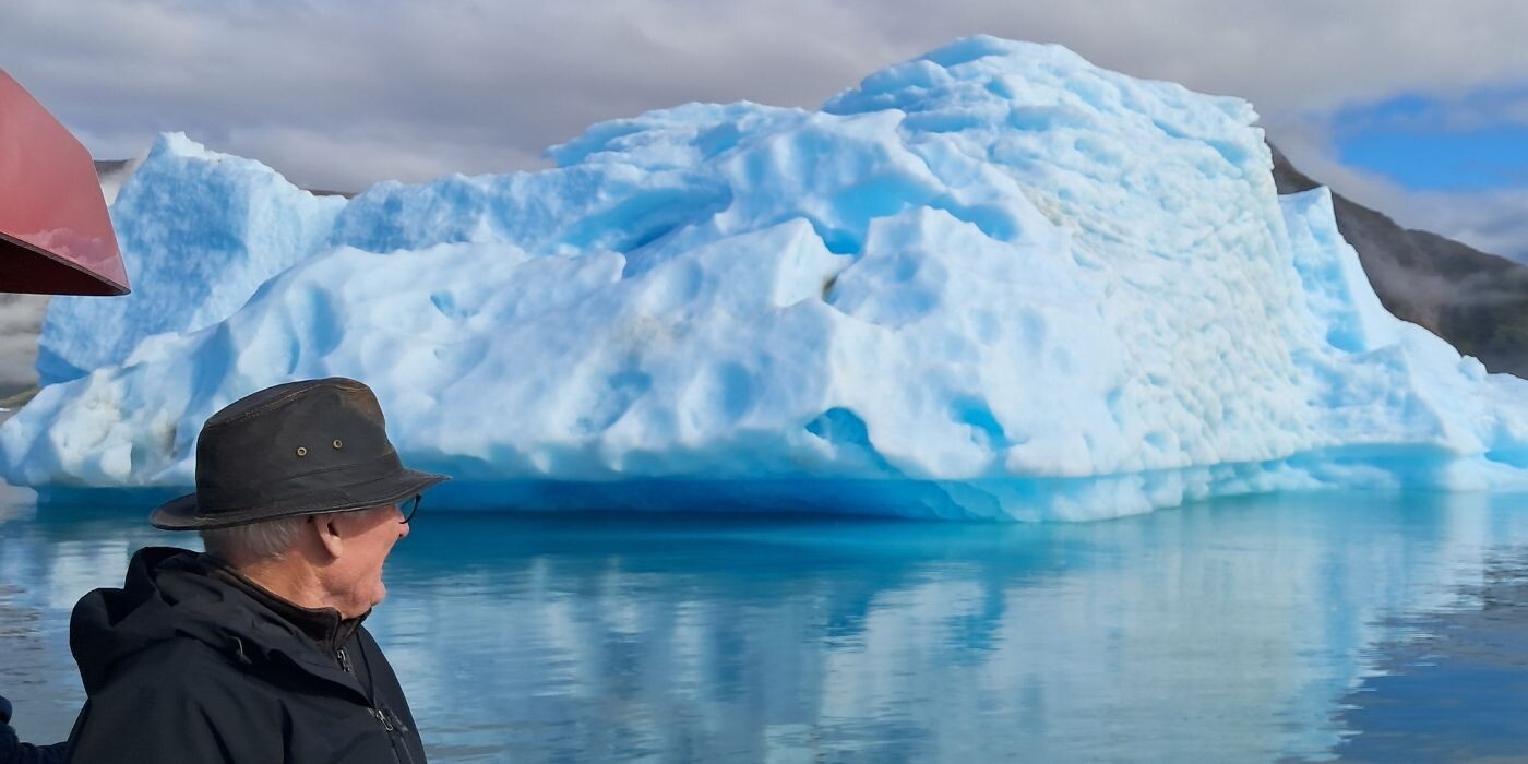
Day 6. Cruise through Qooroq Ice Fjord to Igaliku
After three days of hiking from farm to farm, today offers a more relaxed pace. From Sillisit, we pick you up by boat and sail into the Qooroq Ice Fjord, where massive icebergs drift in constantly changing shapes and shades.
Today’s highlights:
- As you approach the glacier, the engine is turned off, allowing you to experience the absolute silence of the Arctic—and enjoy a drink chilled with thousand-year-old glacier ice.
- From the ice fjord, the journey continues to Itilleq, followed by a 4 km hike along a scenic unpaved country road to Igaliku, one of the most beautiful villages in Greenland.
- The colourful houses are set in green grasslands beside a milky-blue fjord, while across the water the dramatic peak of Illerfissalik (Burfjeld) rises above the rugged landscape.
Meals: Breakfast
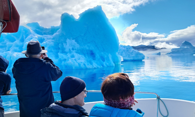
Activity on Day 6 (Included)
Boat Trip to Qooroq Ice Fjord
On the boat trip, we cross the underwater moraine at the mouth of Qooroq Fjord. Many of the large icebergs run aground here, and we sail closely past them to get through and into the fjord. A sight and experience of truly epic proportions.
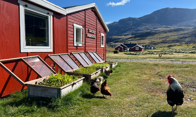
Included Hotel (Day 6)
Igaliku Bygdehotel
In the heart of the historic settlement of Igaliku, you will find Igaliku Bygdehotel, where Greenlandic hospitality meets scenic surroundings. The hotel is surrounded by lush valleys and fjords, making it an ideal base for exploring the area’s Viking history, impressive hiking trails, and relaxing atmosphere.
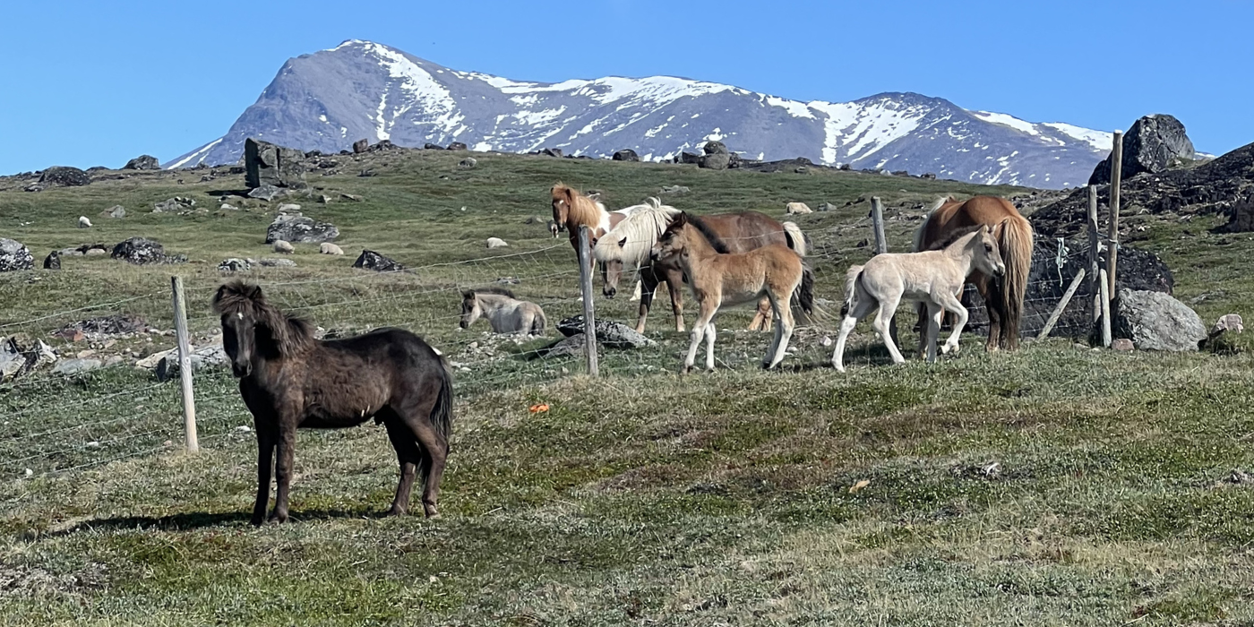
Day 7. Explore Igaliku on a Day Hike or visit the Norse Ruins
Today is dedicated to exploring Igaliku and its surrounding landscapes at your own pace.
Igaliku, known in the Norse era as Gardar, was the episcopal seat for around 300 years between 1100 and 1400. The impressive ruins from this period can still be seen today, offering a unique glimpse into Greenland’s Viking history. In 1782, Anders Olsen and his Greenlandic wife Tuperna settled here as farmers, marking the beginning of the village’s more recent history.
Today, Igaliku is surrounded by some of the finest hiking terrain in South Greenland. Check all the different hiking trails in Igaliku here.
Meals: BreakfastYou may choose between several selfguided day hikes:
.png)
The Plateau Hike (17 km)
One popular route (approx. 17 km) leads to a high plateau with sweeping views over the Qooroq Ice Fjord, where stranded icebergs rest on the underwater moraine and the glacier stretches deep into the fjord. This is an ideal spot for a picnic, and on the return you may even find local minerals such as the shimmering “moonstone” (labradorite). Read more about this hike here.
.png)
The Waterfall Hike (15 km)
Another scenic hike, the “waterfall route” (approx. 15 km), follows a chain of cascading waterfalls flowing like pearls down towards Tunulliarfik Fjord. This hike can also be extended to the summit of Nuuluk Mountain (823 m), offering a challenging but rewarding full-day experience (20–22 km). Read more about this hike here.
_(2)_(3).png)
Included Hotel (Day 7)
Igaliku Bygdehotel
In the heart of the historic settlement of Igaliku, you will find Igaliku Bygdehotel, where Greenlandic hospitality meets scenic surroundings. The hotel is surrounded by lush valleys and fjords, making it an ideal base for exploring the area’s Viking history, impressive hiking trails, and relaxing atmosphere.
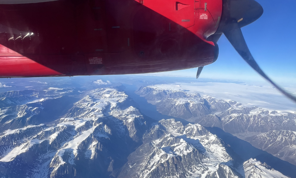
Day 8. Farewell to South Greenland
Depart from Qaqortoq Airport (JJU)
The day begins with a boat transfer from Igaliku to Qaqortoq (approx. 1 hour) and a final glimpse of South Greenland’s fjords and colourful townscape before your return home.
Upon arrival in Qaqortoq, you will be transferred by car to the airport for your departure, taking with you memories of remote sheep farms and unforgettable “alone in the wild” hikes.
Meals: Breakfast
Extend Your Trip?
Do you feel the trip is too short and want to extend it? Whether it’s to another destination in Greenland or simply more time to explore, feel free to ask us. We have extensive knowledge of Greenland and can provide guidance quickly and easily.
Season and practical info
Greenland is a truly unique destination – majestic, yet not always easy to reach. That is part of its charm. Our travel advisors are happy to help you tailor a trip that matches your wishes and interests. As part of our guidance, we also advise you on the best time to plan your journey, ensuring you bring home the most memorable experiences.
About South Greenland and this itinerary
South Greenland is the only place in Greenland where you will find agriculture. Today, more than 30 farms are located throughout the entire region. Often in very remote and beautiful areas with green pastures and sheep, cattle and horses roaming freely in the hills. On this tour we welcome you to visit a few of the farms and get a first-hand experience to the daily life of the Greenlanders who live of the land.
Qaqortoq is the largest town in South Greenland with approximately 3,300 inhabitants. The town serves as an important regional centre for education and training, including an upper secondary school, a business school, vocational education for adults, and programmes within tourism and guide training.
The town also has a number of local enterprises, including Great Greenland, which operates a tannery and sewing facilities producing traditional sealskin garments.
Qaqortoq is particularly known for the Stone & Man project, Greenland's oldest fountain in the town square an the harbour, where local fishermen and hunters often sell the day's catch.
When is the best time to travel?
You can start this tour every day of the week and are free to choose your own pace and what to see and do each day. Just let us know which date/flight you will arrive with and we will book the tour for you as desired.
The best time to travel for this itinerary in South Greenland is from June to September.
Difficulty
The hikes between the farms are mostly easy and follow gravel roads. However, one hike is long (15 km) and with many height meters. Your luggage is transported by car or boat.
Self-guided
All our package tours are self-guided. This means that you are not a part of a bigger group with a tour leader to guide you around. We will send you very detailed information about the tour before you arrive in Greenland.
Accommodation and meals
Accommodation at guest houses (private room at hotels and farms with shared toilet facilities). Rooms include bed linens and towels.
Meals
Breakfast is included.
Cooking facilities available at all sheep farms and in Narsarsuaq so you can prepare your own meals. You can also choose to prebook dinner at some/all sheep farms. A nice way to meet the local family at the farm. All dinners have to be ordered in advance and paid directly to the farmer on site. Prices are around 350 DKK/meal.
You can go shopping in Narsarsuaq, Qassiarsuk and Igaliku.
At the hotels in Igaliku and Qaqortoq you can buy dinner and lunch packs.
How to get here
There are direct flights to Qaqortoq (South Greenland) from Nuuk (GOH) all year round and from Iceland (Reykjavik, KEF) in the high season from mid-June to early September.
Tickets can be purchased at the airlines’ websites:
- Air Greenland flies from Nuuk to Qaqortoq.
- Icelandair flies from Reykjavik to Qaqortoq. Iceland air provides connecting flights from many major cities in US and EU. With just one stopover in Reykjavik.
Several airlines fly from Europe and the US to Denmark and Iceland.
Please notice, flight tickets are not included in any of our tours or products.
Food and drink
Meat and fish are the foundation of the Greenlandic diet, so be prepared for high-protein fare with relatively few vegetables and side dishes.
In South Greenland you will primarily be served lamb, but also musk ox, reindeer and whale meat. Cod, trout and shrimp are the most common fish and seafood used in South Greenlandic cuisine.
If you have an opportunity to cook your own meals, you won’t want to miss out on a visit to the local meat and fish market, where hunters and fishermen sell the catch of the day.
In South Greenland several sheep farmers have also begun to grow potatoes, turnips, lettuce and cabbage on a larger scale and you can enjoy this fresh produce if you are travelling in late summer.
Opening hours
There are grocery stores (the Pilersuisoq chain) in the villages of Narsarsuaq, Qassiarsuk and Igaliku, where you can buy canned, dried and frozen food, and to a limited extend fresh products. If your package tour includes one of the major towns, we always recommend that you buy food in a supermarket there before continuing on to a small village.
In the towns of Narsaq, Qaqortoq and Nanortalik shops are generally open from 8-9 am to 5-6 pm on weekdays, with slightly shorter opening hours on Saturdays and Sundays. In the settlements (Narsarsuaq, Qassiarsuk and Igaliku) shop opening hours are somewhat more limited: weekdays often from 10 am to 3 pm, Saturdays 10-12 am and closed on Sundays.
About dining in villages and on sheep farms
We always recommend that you take the opportunity to eat locally and taste different Greenlandic dishes when you visit a sheep farm or a small settlement. However, please do not expect a large variety of dishes (à la carte menu), as well as a special children’s menu or vegetarian dishes at such places, as shopping facilities and the choice of products are limited.
If you are a vegetarian or have a food allergy (e.g., allergic to gluten), you may want to consider bringing some food along with you, unless you will be staying in the vicinity of a supermarket in one of the major towns!
Costs
The price level of food in shops is roughly the same as in the rest of Northern Europe. Fresh fruit and vegetables, alcoholic drinks and sweets are the most expensive. See below for indicative prices for meals in cafes/restaurants:
Lunch at cafes/hotels: DKK 120-150 (approx. 16-20 EUR)
Dinner at cafeteria / sheep farm / restaurant: DKK 120 (approx. 16 EUR) / DKK 200-300 (approx. 27-40 EUR) / DKK 200-400 (approx. 27-54 EUR)
These prices are without drinks
1 beer at a bar/restaurant: from DKK 50 (approx. 7 EUR)
1 bottle of wine at a restaurant: from DKK 230 (approx. 31 EUR)
Money, Tele & Internet
Currency and Credit cards
The currency used in Greenland is the Danish krone (DKK). You can pay by credit card in stores (also in the settlements), at hotels, restaurants (including the Igaliku Country Hotel) and at tourist offices. However, it is a good idea to have a small amount of cash with you, especially if you are going to stay and dine on a sheep farm, where cash is the only means of payment. There are ATMs in the towns of Narsaq, Qaqortoq and Nanortalik.
Telephony
There is mobile coverage in all towns and villages. Most European telecommunications providers have roaming agreements with Tele Greenland, but it might be quite expensive to use your phone in Greenland. You should also not rely on your mobile phone as a means of communicating with the outside world on a hiking trip, as there are many places in the countryside/mountains where you will not have a signal. If you are planning a longer hiking or kayaking trip in isolated areas, for safety reasons we recommend that you rent a satellite phone.
Internet
There is wireless internet at most hotels and hostels in the towns (including Narsarsuaq and the Igaliku Country Hotel). At most tourist offices you can also borrow a computer to check your emails and so on. What all of these points of access have in common is that you pay for the use of the internet in Greenland and – compared to the rest of Europe – it is quite expensive.
Mobile Phone
Using mobile data from an international phone can be very expensive in Greenland. Make sure to check what your plan covers before enabling data roaming. If you need a Greenlandic SIM card, we recommend Tusass eSIM packages. See prices and packages here (affiliate link).
Access to Electricity
It is possible to charge your devices at the accommodations (bring your own charger).
IMPORTANT NOTE!
Please note that the price of the trip is a starting price, as there may be additional costs for a more expensive type of flight ticket or a different cabin/room standard, depending on availability at the time of booking. You are, of course, only committed to the trip once any price supplements have been confirmed. The starting price is indicated for Greenland’s low season.
Right to Changes Reserved. Please note that a trip like this is weather-dependent, and some changes to the program may occur. Delays and cancellations are possible, especially for flights and boat transport.
No compensation or reimbursement is provided for the first 24 hours of delays or changes due to external circumstances. We will make every effort to minimize inconvenience, provide an alternative program, or make the most of the extra waiting time.
What to bring
For our package tours in South Greenland we recommend:
- A sleeping bag and towel (only if you stay in hostels)
- Slippers or sandals (for use indoors when you stay at hostels/farms or visit a Greenlandic home)
- Hiking boots or solid walking shoes
- Wind and waterproof outerwear
- Sweater or fleece for insulation
- T-shirts and long-sleeved blouses (it can get really hot in the sun on land)
- A knit hat and gloves (it can be rather chilly on a boat trip to the ice fjord)
- A mosquito net and mosquito repellent (which can also be purchased at Blue Ice Café). The mosquitoes are worst in June and early July in southern Greenland. There may be small, annoying flies in August. Mosquitoes are virtually non-existent in sheep farming areas, but can be troublesome in Narsarsuaq and mountain areas with few or no sheep
- Sunglasses and sun lotion
_(2)_(3)_(4).png)
Tour Description
South Greenland is a region of contrasts, where colourful towns, peaceful settlements, Norse history, and spectacular fjord landscapes come together in one journey.
During this 8-day tour, you will explore the charming town of Narsaq, beautifully situated among luxuriant hills and iceberg-filled waters, as well as Qaqortoq, South Greenland's largest town, where colourful colonial houses stand alongside a vibrant modern community.
The lively atmosphere of the towns contrasts sharply with the undisturbed calmness and slower pace of life in Igaliku – one of the most beautiful villages in South Greenland.
Along the way, you will visit the historic Norse site of Brattahlid and sail among the blue icebergs of the spectacular Qooroq Ice Fjord, making this tour an ideal introduction to the culture and history of South Greenland's towns and settlements.
.png)
Trip Highlights
- Explore the colourful towns of Narsaq and Qaqortoq at your own pace
- Visit the historic Norse settlements of Brattahlid and Gardar
- Sail among turquoise icebergs in the spectacular Qooroq Ice Fjord
- Experience the calmness of the picturesque village of Igaliku
- Enjoy optional hikes through some of South Greenland's most beautiful landscapes
Price Includes
The price estimate is based on the inclusion of the elements listed below. The final travel itinerary will be prepared in collaboration with our travel advisor, who will create a travel offer based on this.
Accommodations
- All accommodation incl. breakfast*
- 2 nights in Hotel Narsaq
- 1 night in Narsarsuaq
- 2 nights in Igaliku Country Hotel
- 2 nights in Hotel Qaqortoq
* Please note: All included accommodation at hotel and guest house with private or shared facilities. Read more here.
Meals
- 7x Breakfast at the accommodations
Excursions and Transportation
- Transport of luggage
- All boat transfers
- Boat trip to the Qooroq Ice Fjord
- Airport transfers in Qaqortoq
Other
- Tourist tax
Price excludes
- Flights
- Pocket money and expenses for beverages
- Other meals than those listed under “Price Includes”
- Other excursions than those listed under “Price Includes”
- Tour guide (this trip is self-guided)
- Travel and/or cancellation insurance
- Single room supplement, Approx EUR ??? per person
Travel safely to Greenland with Topas – we are with you every step of the way
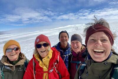
When you choose to travel with Greenland by Topas, you choose more than just transportation and accommodation. You choose a complete travel experience, where nature, culture, and personal guidance go hand in hand—before, during, and after your journey.
This is why many choose us:
Tailor-made journeys – with you at the center
We arrange package tours without a tour leader, but with a high degree of security and guidance. You travel independently, but you are never left on your own.
Experienced Greenland specialists
Our advisor, Line Vinterberg, who has led Topas group tours in Greenland, knows the country intimately and is ready to help you tailor your journey—whether you dream of Disko Bay, Narsarsuaq, or something entirely different.
Personal guidance – every step of the way
We assist you with planning, booking, and practical details, so you can focus on what matters most: your experiences in Greenland. You receive a well-prepared itinerary and access to experienced local partners along the way.
Local knowledge and strong partnerships
Topas has been organizing trips to Greenland since 1998 and today works closely with, among others, Disko Line, Blue Ice Explorer, and several hotels in Disko Bay—giving you access to the best experiences and facilities.
Safety and responsibility
Topas is a member of the Danish Travel Agency Association and part of the Travel Guarantee Fund. In addition, we are affiliated with the UN Global Compact and actively work with responsible tourism and sustainable values.
Your Itinerary
The day-by-day travel program below is a recommended itinerary combining the towns and settlements in South Greenland over 8 days / 7 nights.
The program is indicative and can be customized according to your choice of activities and hotels. The price indication is a guideline for the proposed trip and may vary depending on the season and your preferences. Upon inquiry, a specific travel offer will be prepared.
Please note! Due to limited capacity at some overnight accommodations, the order of the itinerary may change.
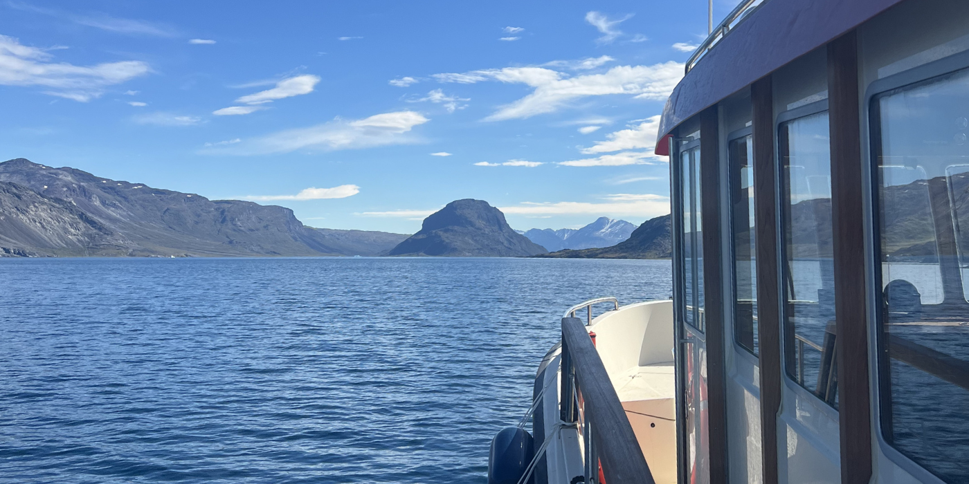
Day 1. Welcome to South Greenland
Arrive at Qaqortoq Airport (JJU)
Today you arrive in South Greenland, followed by a boat journey to Narsaq where you will spend your first night.
Today's highlights:
- A short transfer takes you from the airport to the harbour in Qaqortoq.
- Enjoy a scenic boat journey through the fjords of South Greenland to Narsaq (approx. 45 minutes).
- Arrive in Narsaq, a charming town surrounded by mountains, fjords, and some of South Greenland's most beautiful landscape.
Included Accommodation (Day 1)
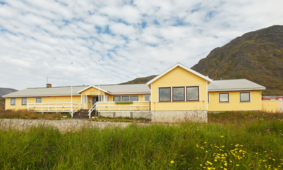
Narsaq Hotel
Hotel Narsaq, a family-run hotel, is located near the foot of the mountain Kvanefjeldet.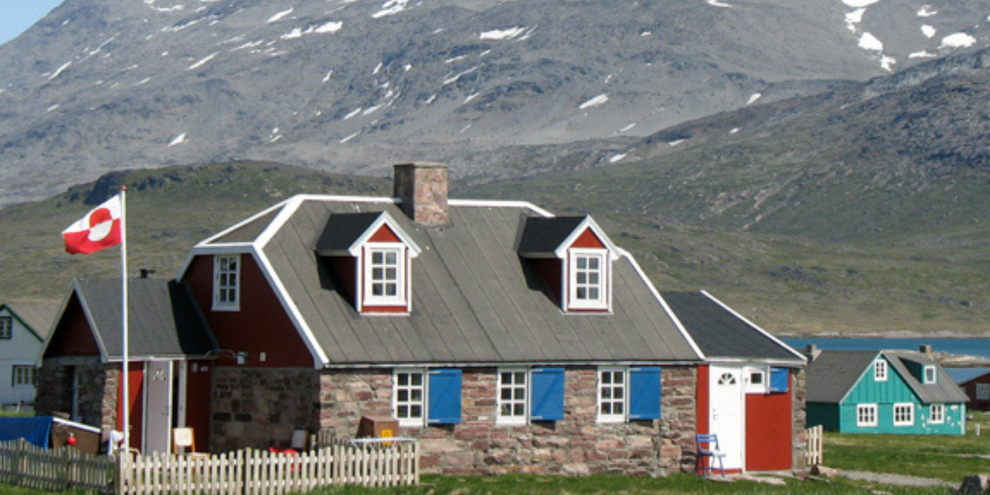
Day 2. Explore Narsaq at Your Own Pace
Today is yours to explore Narsaq and its beautiful surroundings. Narsaq is a medium-sized town in South Greenland with about 1,500 inhabitants. In the backcountry are high mountains, including the famous Kvanefjeld, which contains over 200 different minerals (including the beautiful, pink gemstone Tugtupit) and is a Mecca for anyone interested in geology.
Today's highlights:
- Discover Narsaq, a charming town situated at the foot of a mountain and beside a sound where icebergs from the surrounding glaciers drift by year-round.
- Visit the local museum, located in the historic colonial buildings by the old harbour, and learn more about the history and culture of South Greenland.
- Choose from several shorter and longer hiking routes around Narsaq, including the walks to Narsaq Point and Dyrnæs (7-8 km), the summit of Tasiigaaq (a landmark for Narsaq), or the mineral-rich Kvanefjeld area.
You may also choose to buy a tour by boat to the Ice Cap or an iceberg safari. We recommend booking these tours in advance.
Hiking tip! If you want to visit Kvanefjeld, we advise that you take a taxi to the sheep farm in the valley (about 7 km). Otherwise, it is quite a long day hike (20-25 km), and you have less time to look for stones! For hiking recommendations and local information, visit the tourist office located near the museum.
Meals: Breakfast
.png)
Included Accommodation (Day 2)
Narsaq Hotel
Hotel Narsaq, a family-run hotel, is located near the foot of the mountain Kvanefjeldet.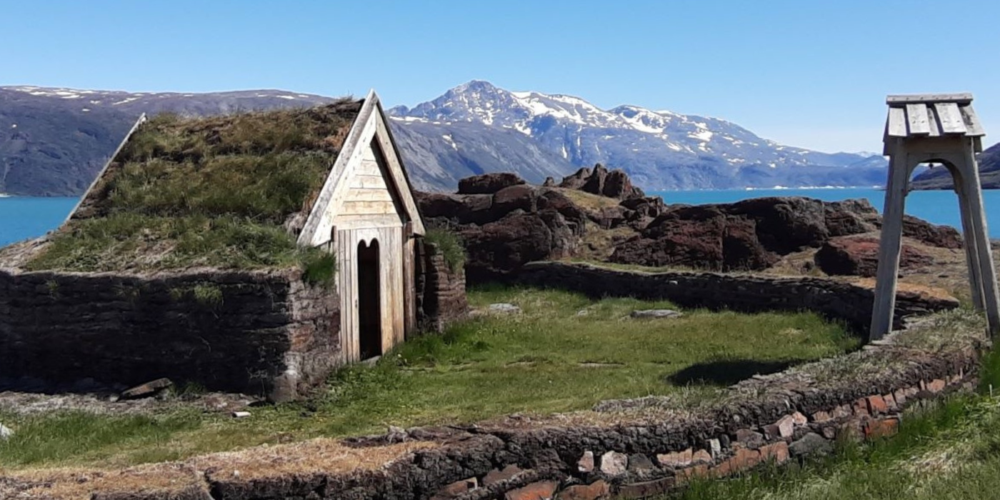
Day 3. Qassiarsuk: Norse History & Greenlandic Farm Life
Today, you travel by boat from Narsaq to Qassiarsuk (approx. 1 hour). The approx. 40 inhabitants earn their livelihoods from sheep farming, but the village also has a school, a shop and a church.
Today's highlights:
-
Visit Qassiarsuk, also known as Brattahlid, where Erik the Red established his settlement in AD 982.
-
Explore the well-preserved Norse ruins and visit the Brattahlid open-air museum (admission fee not included).
-
Experience life in one of South Greenland's small farming communities, where sheep farming remains an important part of daily life.
After a couple of hours in Qassiarsuk, you continue by boat across the fjord to Narsarsuaq (approx. 10 minutes).
Meals: Breakfast
_(2).png)
Included hotel (Day 3)
Narsarsuaq Hostel
The hostel is nestled at the foot of a mountain with a view of the fjord. In the summertime there is always a pleasant atmosphere, with hikers and travellers exchanging experiences and planning tours.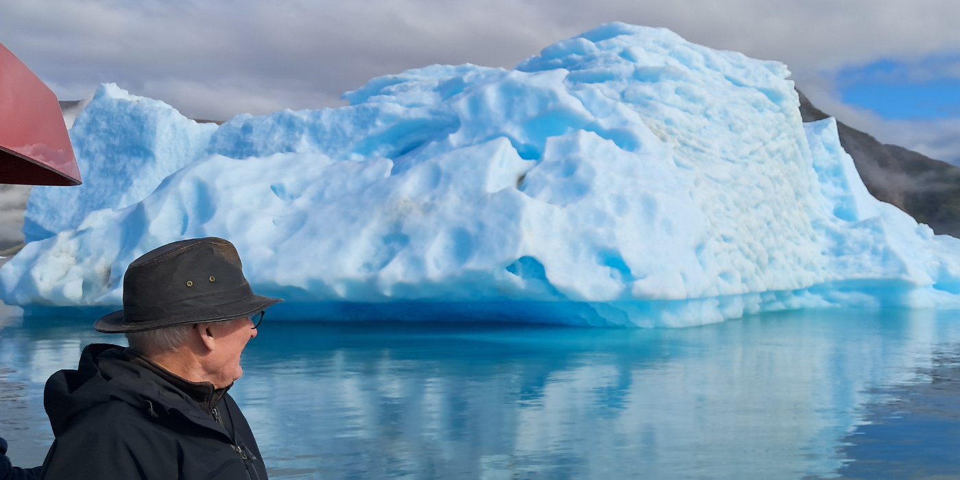
Day 4. Qooroq Ice Fjord & Arrival in Igaliku
Today begins with a boat excursion from Narsarsuaq to the spectacular Qooroq Ice Fjord (approx. 1.5 hours).
Today's highlights:
- Sail among icebergs of all colours, sizes and shapes. When the glacier is in view, the boat engine is stopped, so you can enjoy the absolute silence and a drink chilled with glacier ice – more than 1000 years old!
- From Itilleq, follow a scenic 4 km hike along a picturesque unpaved country road to Igaliku, one of the most beautiful villages in Greenland!
- Admire the colourful houses set on lush grasslands beside a milky-blue fjord, with the dramatic peak of Illerfissalik (Burfjeld) rising across the water.
Meals: Breakfast
.png)
Activity on Day 4 (Included)
Boat Trip to Qooroq Ice Fjord
On the boat trip, we cross the underwater moraine at the mouth of Qooroq Fjord. Many of the large icebergs run aground here, and we sail closely past them to get through and into the fjord. A sight and experience of truly epic proportions.
.png)
Included Hotel (Day 4)
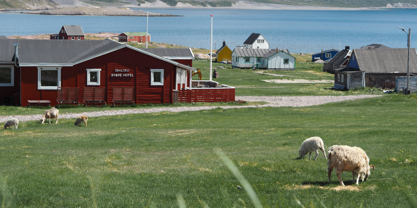
Igaliku Bygdehotel
In the heart of the historic settlement of Igaliku, you will find Igaliku Bygdehotel, where Greenlandic hospitality meets scenic surroundings. The hotel is surrounded by lush valleys and fjords, making it an ideal base for exploring the area’s Viking history, impressive hiking trails, and relaxing atmosphere.
Day 5. Explore Igaliku at your own pace
Today is dedicated to exploring Igaliku and its surrounding landscapes at your own pace.
Igaliku, known in the Norse era as Gardar, was the episcopal seat for around 300 years between 1100 and 1400. The impressive ruins from this period can still be seen today, offering a unique glimpse into Greenland’s Viking history. In 1782, Anders Olsen and his Greenlandic wife Tuperna settled here as farmers, marking the beginning of the village’s more recent history.
Today, Igaliku is surrounded by some of the finest hiking terrain in South Greenland. Check all the different hiking trails in Igaliku here.
Meals: BreakfastYou may choose between several selfguided day hikes:
The Plateau Hike (17 km)
One popular route (approx. 17 km) leads to a high plateau with sweeping views over the Qooroq Ice Fjord, where stranded icebergs rest on the underwater moraine and the glacier stretches deep into the fjord. This is an ideal spot for a picnic, and on the return you may even find local minerals such as the shimmering “moonstone” (labradorite). Read more about this hike here.
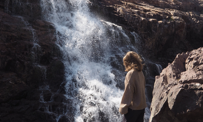
The Waterfall Hike (15 km)
Another scenic hike, the “waterfall route” (approx. 15 km), follows a chain of cascading waterfalls flowing like pearls down towards Tunulliarfik Fjord. This hike can also be extended to the summit of Nuuluk Mountain (823 m), offering a challenging but rewarding full-day experience (20–22 km). Read more about this hike here.
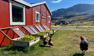
Included Hotel (Day 5)
Igaliku Bygdehotel
In the heart of the historic settlement of Igaliku, you will find Igaliku Bygdehotel, where Greenlandic hospitality meets scenic surroundings. The hotel is surrounded by lush valleys and fjords, making it an ideal base for exploring the area’s Viking history, impressive hiking trails, and relaxing atmosphere.
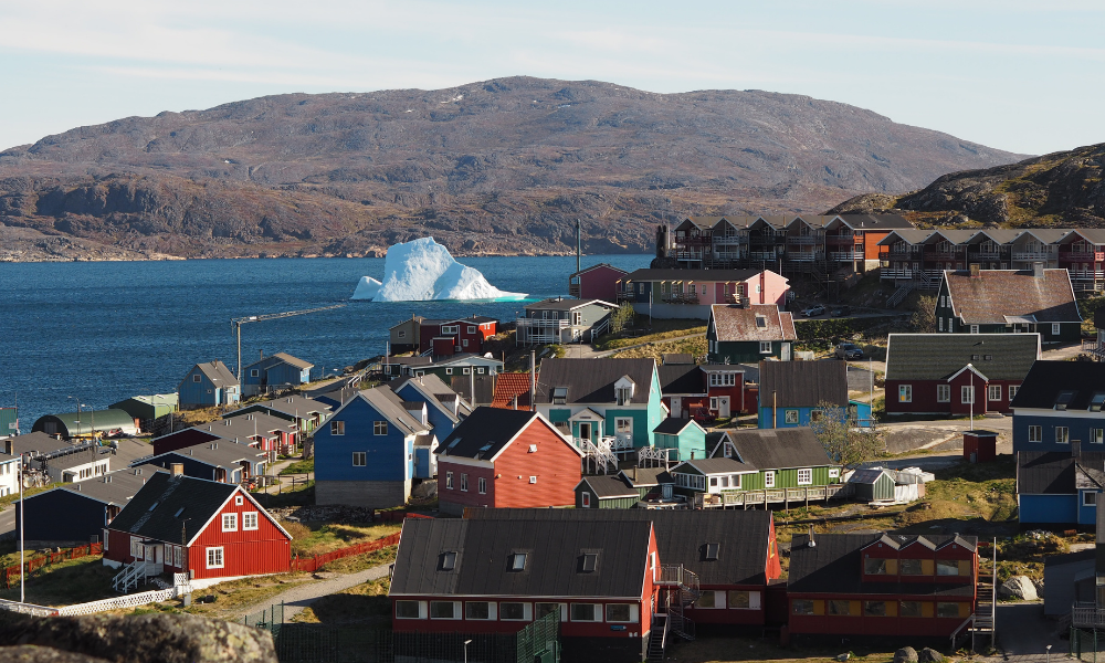
Day 6. Arrive in Qaqortoq, the largest town in South Greenland
Today, you enjoy a scenic boat journey through the fjords of South Greenland – from Igaliku to Qaqortoq (approx. 1 hour). You can spend the rest of the day exploring the town at your own pace.
Qaqortoq is the largest town in South Greenland with about 3,300 inhabitants. It is the main centre of education in South Greenland with an upper secondary school, a business school, a vocational school adults and a school for tourism management and guide training.
Furthermore, the town has several fair-sized companies such as Great Greenland, with its tannery and sewing facilities for creating beautiful sealskin clothes.
Meals: Breakfast
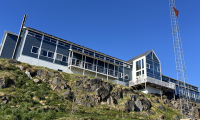
Included Hotel (Day 6)
Hotel Qaqortoq
★ ★ ★ ★The phrase “Home – away from home” is not just a slogan but a central guiding principle for Hotel Qaqortoq and its staff. This 4-star hotel enjoys one of the town’s best locations, with views over the harbor and town center, making it a natural gathering place for both guests and locals.
Read more about the hotel.
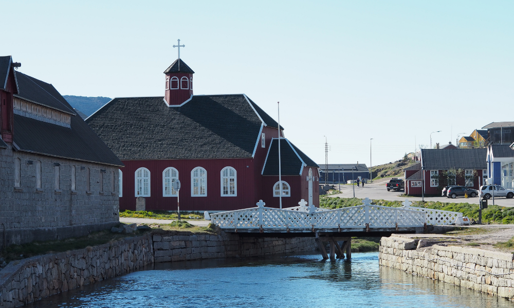
Day 7. Explore Qaqortoq at Your Own Pace
Today is yours to discover Qaqortoq and its surroundings. With colourful houses, a lively harbour, and a thriving local community, Qaqortoq is the cultural and commercial centre of South Greenland.
Today's highlights:
Discover the famous Stone & Man project, which consists of more than 30 sculptures that are carved into the granite bedrock by various artists. This permanent exhibition makes a stroll around the city a very special experience.
Visit the town square and Greenland's oldest fountain, located next to the harbour. Here you can sit and watch the hunters and fishermen selling the catch of the day at the nearby fish market.
Explore the charming streets of Qaqortoq and experience everyday life in South Greenland's largest town.
There is also the option to join an excursion to the historic Hvalsey Church, one of the best-preserved Norse ruins in Greenland (advance booking recommended).
Meals: Breakfast.png)
Included Accommodation (Day 7)
Hotel Qaqortoq
★ ★ ★ ★The phrase “Home – away from home” is not just a slogan but a central guiding principle for Hotel Qaqortoq and its staff. This 4-star hotel enjoys one of the town’s best locations, with views over the harbor and town center, making it a natural gathering place for both guests and locals.
Read more about the hotel.
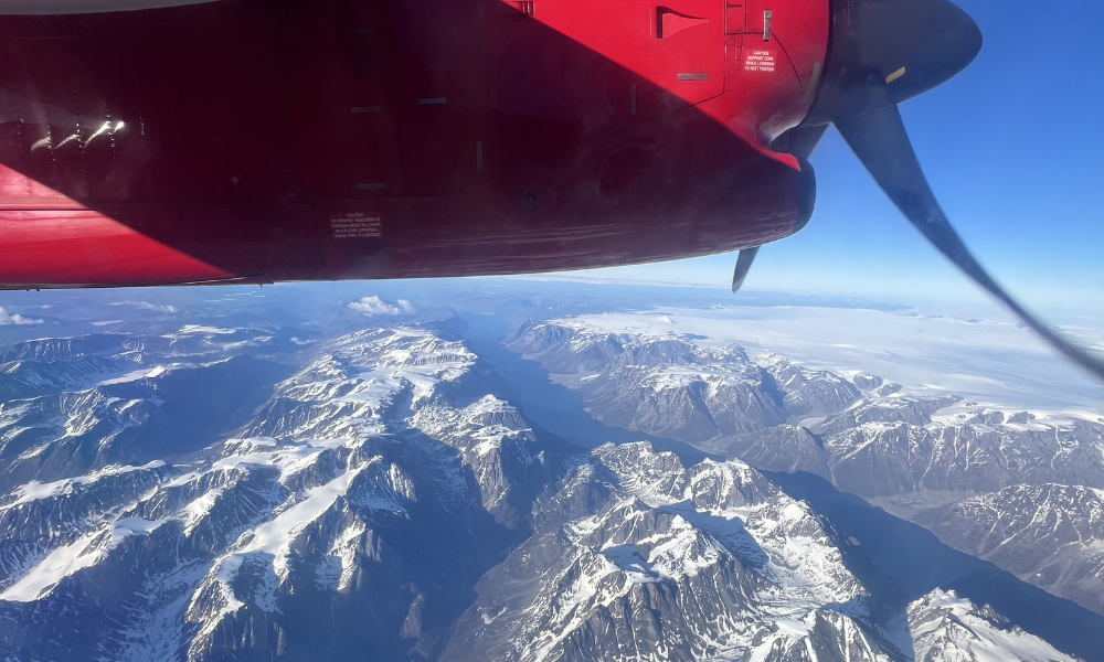
Day 8. Farewell to South Greenland
Depart from Qaqortoq Airport (JJU)
Take a final glimpse of South Greenland’s fjords and colourful townscape before your return home.
From Qaqortoq, you will be transferred by car to the airport for your departure, taking with you memories of everyday life in som of the worlds most remote towns and settlements.
Meals: Breakfast
Extend Your Trip?
Do you feel the trip is too short and want to extend it? Whether it’s to another destination in Greenland or simply more time to explore, feel free to ask us. We have extensive knowledge of Greenland and can provide guidance quickly and easily.
Season and practical info
Greenland is a truly unique destination – majestic, yet not always easy to reach. That is part of its charm. Our travel advisors are happy to help you tailor a trip that matches your wishes and interests. As part of our guidance, we also advise you on the best time to plan your journey, ensuring you bring home the most memorable experiences.
About South Greenland and this itinerary
South Greenland is the only place in Greenland where you will find agriculture. Today, more than 30 farms are located throughout the entire region. Often in very remote and beautiful areas with green pastures and sheep, cattle and horses roaming freely in the hills. On this tour we welcome you to visit a few of the farms and get a first-hand experience to the daily life of the Greenlanders who live of the land.
Qaqortoq is the largest town in South Greenland with approximately 3,300 inhabitants. The town serves as an important regional centre for education and training, including an upper secondary school, a business school, vocational education for adults, and programmes within tourism and guide training.
The town also has a number of local enterprises, including Great Greenland, which operates a tannery and sewing facilities producing traditional sealskin garments.
Qaqortoq is particularly known for the Stone & Man project, Greenland's oldest fountain in the town square an the harbour, where local fishermen and hunters often sell the day's catch.
When is the best time to travel?
You can start this tour every day of the week and are free to choose your own pace and what to see and do each day. Just let us know which date/flight you will arrive with and we will book the tour for you as desired.
The best time to travel for this itinerary in South Greenland is from June to September.
Difficulty
No special requirements on this trip. The hike between Itilleq and Igaliku is 4 km.
Self-guided
All our package tours are self-guided. This means that you are not a part of a bigger group with a tour leader to guide you around. We will send you very detailed information about the tour before you arrive in Greenland.
Accommodation and meals
Accommodation at hotel and guest house with private or shared facilities.
Meals
Breakfast is included.
Dinner and lunch packets can be ordered at all the hotels. In Narsarsuaq we have a self catering kitchen available at our guest house so you can prepare your own meals.
How to get here
There are direct flights to Qaqortoq (South Greenland) from Nuuk (GOH) all year round and from Iceland (Reykjavik, KEF) in the high season from mid-June to early September.
Tickets can be purchased at the airlines’ websites:
- Air Greenland flies from Nuuk to Qaqortoq.
- Icelandair flies from Reykjavik to Qaqortoq. Iceland air provides connecting flights from many major cities in US and EU. With just one stopover in Reykjavik.
Several airlines fly from Europe and the US to Denmark and Iceland.
Please notice, flight tickets are not included in any of our tours or products.
Food and drink
Meat and fish are the foundation of the Greenlandic diet, so be prepared for high-protein fare with relatively few vegetables and side dishes.
In South Greenland you will primarily be served lamb, but also musk ox, reindeer and whale meat. Cod, trout and shrimp are the most common fish and seafood used in South Greenlandic cuisine.
If you have an opportunity to cook your own meals, you won’t want to miss out on a visit to the local meat and fish market, where hunters and fishermen sell the catch of the day.
In South Greenland several sheep farmers have also begun to grow potatoes, turnips, lettuce and cabbage on a larger scale and you can enjoy this fresh produce if you are travelling in late summer.
Opening hours
There are grocery stores (the Pilersuisoq chain) in the villages of Narsarsuaq, Qassiarsuk and Igaliku, where you can buy canned, dried and frozen food, and to a limited extend fresh products. If your package tour includes one of the major towns, we always recommend that you buy food in a supermarket there before continuing on to a small village.
In the towns of Narsaq, Qaqortoq and Nanortalik shops are generally open from 8-9 am to 5-6 pm on weekdays, with slightly shorter opening hours on Saturdays and Sundays. In the settlements (Narsarsuaq, Qassiarsuk and Igaliku) shop opening hours are somewhat more limited: weekdays often from 10 am to 3 pm, Saturdays 10-12 am and closed on Sundays.
About dining in villages and on sheep farms
We always recommend that you take the opportunity to eat locally and taste different Greenlandic dishes when you visit a sheep farm or a small settlement. However, please do not expect a large variety of dishes (à la carte menu), as well as a special children’s menu or vegetarian dishes at such places, as shopping facilities and the choice of products are limited.
If you are a vegetarian or have a food allergy (e.g., allergic to gluten), you may want to consider bringing some food along with you, unless you will be staying in the vicinity of a supermarket in one of the major towns!
Costs
The price level of food in shops is roughly the same as in the rest of Northern Europe. Fresh fruit and vegetables, alcoholic drinks and sweets are the most expensive. See below for indicative prices for meals in cafes/restaurants:
Lunch at cafes/hotels: DKK 120-150 (approx. 16-20 EUR)
Dinner at cafeteria / sheep farm / restaurant: DKK 120 (approx. 16 EUR) / DKK 200-300 (approx. 27-40 EUR) / DKK 200-400 (approx. 27-54 EUR)
These prices are without drinks
1 beer at a bar/restaurant: from DKK 50 (approx. 7 EUR)
1 bottle of wine at a restaurant: from DKK 230 (approx. 31 EUR)
Money, Tele & Internet
Currency and Credit cards
The currency used in Greenland is the Danish krone (DKK). You can pay by credit card in stores (also in the settlements), at hotels, restaurants (including the Igaliku Country Hotel) and at tourist offices. However, it is a good idea to have a small amount of cash with you, especially if you are going to stay and dine on a sheep farm, where cash is the only means of payment. There are ATMs in the towns of Narsaq, Qaqortoq and Nanortalik.
Telephony
There is mobile coverage in all towns and villages. Most European telecommunications providers have roaming agreements with Tele Greenland, but it might be quite expensive to use your phone in Greenland. You should also not rely on your mobile phone as a means of communicating with the outside world on a hiking trip, as there are many places in the countryside/mountains where you will not have a signal. If you are planning a longer hiking or kayaking trip in isolated areas, for safety reasons we recommend that you rent a satellite phone.
Internet
There is wireless internet at most hotels and hostels in the towns (including Narsarsuaq and the Igaliku Country Hotel). At most tourist offices you can also borrow a computer to check your emails and so on. What all of these points of access have in common is that you pay for the use of the internet in Greenland and – compared to the rest of Europe – it is quite expensive.
Mobile Phone
Using mobile data from an international phone can be very expensive in Greenland. Make sure to check what your plan covers before enabling data roaming. If you need a Greenlandic SIM card, we recommend Tusass eSIM packages. See prices and packages here (affiliate link).
Access to Electricity
It is possible to charge your devices at the accommodations (bring your own charger).
IMPORTANT NOTE!
Please note that the price of the trip is a starting price, as there may be additional costs for a more expensive type of flight ticket or a different cabin/room standard, depending on availability at the time of booking. You are, of course, only committed to the trip once any price supplements have been confirmed. The starting price is indicated for Greenland’s low season.
Right to Changes Reserved. Please note that a trip like this is weather-dependent, and some changes to the program may occur. Delays and cancellations are possible, especially for flights and boat transport.
No compensation or reimbursement is provided for the first 24 hours of delays or changes due to external circumstances. We will make every effort to minimize inconvenience, provide an alternative program, or make the most of the extra waiting time.
What to bring
For our package tours in South Greenland we recommend:
- A sleeping bag and towel (only if you stay in hostels)
- Slippers or sandals (for use indoors when you stay at hostels/farms or visit a Greenlandic home)
- Hiking boots or solid walking shoes
- Wind and waterproof outerwear
- Sweater or fleece for insulation
- T-shirts and long-sleeved blouses (it can get really hot in the sun on land)
- A knit hat and gloves (it can be rather chilly on a boat trip to the ice fjord)
- A mosquito net and mosquito repellent (which can also be purchased at Blue Ice Café). The mosquitoes are worst in June and early July in southern Greenland. There may be small, annoying flies in August. Mosquitoes are virtually non-existent in sheep farming areas, but can be troublesome in Narsarsuaq and mountain areas with few or no sheep
- Sunglasses and sun lotion
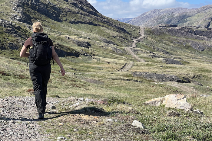
Tour Description
This 13-day backpacking adventure takes you off the beaten track to some of the finest hiking opportunities in South Greenland. Experience life in small Greenlandic communities and at authentic sheep farms.
Along the way, you stay at two sheep farms, visit two settlements, and spend time in the town of Narsaq, using each location as a base for exploring the surrounding landscapes on foot.
Wherever you go, the ice is present all the time - glaciers, icebergs and the amazing ice cap on the horizon! The package includes accommodation and all necessary boat transfers.
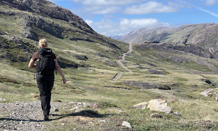
Trip Highlights
- Stay at authentic sheep farms in remote South Greenland
- Hike to viewpoints overlooking glaciers, icebergs, and the Ice Cap
- Experience true “alone in the wild” hiking far from roads and settlements
- Explore the picturesque villages of Tasiusaq and Igaliku
- Discover the spectacular landscapes of Sermilik Fjord and Qooroq Ice Fjord
Price Includes
The price estimate is based on the inclusion of the elements listed below. The final travel itinerary will be prepared in collaboration with our travel advisor, who will create a travel offer based on this.
Accommodations
- All accommodation excl. meals*
- 3 nights in Narsaq Guesthouse
- 2 nights in Narsarsuaq
- 2 nights in Sermilik Hostel - Tasiusaq
- 1 night in Sillisit Farm
- 3 nights in Igaliku Country Hotel
- 1 night in Hotel Qaqortoq
Meals
- 3 x Breakfast at Igaliku Country Hotel
- 3 x Breakfast at Narsaq Guest House
Excursions and Transportation
- All boat transfers
- Airport transfers in Qaqortoq
Other
- Tourist tax (Approx. DKK 30 / 4 EUR per person, per night)
Price excludes
- Flights
- Transport of luggage
- Pocket money and expenses for beverages
- Breakfast at hostels/farms
- Other meals than those listed under “Price Includes”
- Other excursions than those listed under “Price Includes”
- Tour guide (this trip is self-guided)
- Travel and/or cancellation insurance
- Single traveler fee, Aprox EUR ??? per person
Travel safely to Greenland with Topas – we are with you every step of the way
_(2).jpg)
When you choose to travel with Greenland by Topas, you choose more than just transportation and accommodation. You choose a complete travel experience, where nature, culture, and personal guidance go hand in hand—before, during, and after your journey.
This is why many choose us:
Tailor-made journeys – with you at the center
We arrange package tours without a tour leader, but with a high degree of security and guidance. You travel independently, but you are never left on your own.
Experienced Greenland specialists
Our advisor, Line Vinterberg, who has led Topas group tours in Greenland, knows the country intimately and is ready to help you tailor your journey—whether you dream of Disko Bay, Narsarsuaq, or something entirely different.
Personal guidance – every step of the way
We assist you with planning, booking, and practical details, so you can focus on what matters most: your experiences in Greenland. You receive a well-prepared itinerary and access to experienced local partners along the way.
Local knowledge and strong partnerships
Topas has been organizing trips to Greenland since 1998 and today works closely with, among others, Disko Line, Blue Ice Explorer, and several hotels in Disko Bay—giving you access to the best experiences and facilities.
Safety and responsibility
Topas is a member of the Danish Travel Agency Association and part of the Travel Guarantee Fund. In addition, we are affiliated with the UN Global Compact and actively work with responsible tourism and sustainable values.
Your Itinerary
The day-by-day travel program below is a recommended itinerary combining backpacking and hiking in South Greenland over 13 days / 12 nights.
The program is indicative and can be customized according to your choice of activities and hotels. The price indication is a guideline for the proposed trip and may vary depending on the season and your preferences. Upon inquiry, a specific travel offer will be prepared.
Please note! Due to limited capacity at some overnight accommodations, the order of the itinerary may change.
Day 1. First taste of South Greenland
Arrive at Qaqortoq Airport (JJU).
Today you arrive in South Greenland, followed by a boat journey to Narsaq where you will spend your first night.
Today's highlights:
- A short transfer takes you from the airport to the harbour in Qaqortoq.
- Enjoy a scenic boat journey through the fjords of South Greenland to Narsaq (approx. 45 minutes).
- Arrive in Narsaq where you will spend the coming days.
Included Accommodation (Day 1)
Igdlo Guesthouse
Guesthouse and hostel in Narsaq with sleeping bag accommodation, dining room and self-service kitchen available. The guesthouse has an option of double and single rooms with shared faciliteies. Breakfast included.
Day 2–3. Explore Narsaq & Its Surroundings
Spend the next two days exploring Narsaq and the beautiful landscapes surrounding the town. Narsaq is a medium-sized town in South Greenland with about 1,500 inhabitants. It is beautifully situated at the foot of a mountain and next to a sound, which is always filled with icebergs from the surrounding glaciers.
Today's highlights:
- Discover Narsaq, a charming town with high mountains in the backcountry, including the famous Kvanefjeld.
- Explore the famous Kvanefjeld area, which contains over 200 different minerals (including the beautiful, pink gemstone Tugtupit) and is a Mecca for anyone interested in geology.
- Visit the local museum, located in the historic colonial buildings around the old harbour. Definitely worth a stop!
- Choose from several hiking routes around Narsaq, including Narsaq Point and Dyrnæs (7-8 km), the summit of Tasiigaaq (the smaller of the two mountains near the town that serve as a landmark for Narsaq), or longer hikes into the surrounding backcountry.
Hiking tip! If you plan to visit Kvanefjeld, we recommend taking a taxi to the sheep farm in the valley (approx. 7 km) to shorten the hike and allow more time for exploring the area. Otherwise it is quite a long day hike (20-25 km).
Ask for more information at the tourist office, near the museum. From Narsaq you can also buy a tour by boat to the ice cap or an Iceberg safari. We recommend that you book the tour in advance.
Meals: Breakfast.png)
Included Accommodation (Day 2+3)
Igdlo Guesthouse
Guesthouse and hostel in Narsaq with sleeping bag accommodation, dining room and self-service kitchen available. The guesthouse has an option of double and single rooms with shared faciliteies. Breakfast included.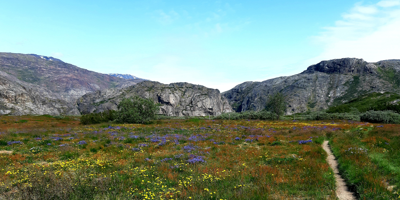
Day 4. Narsarsuaq – Hike to Signal Hill or the Ridge
Today, you travel by boat from Narsaq to Narsarsuaq (approx. 1 hour).
Today's highlights:
- Enjoy a scenic boat journey through the fjords of South Greenland.
- Explore Narsarsuaq at your own pace.
- The area offers some of the beautiful hikes on your own hand and is the place in Greenland with the shortest hiking distance to the Greenland Ice Sheet.
The hike to Narsarsuaq Glacier is approximately 16 km return and includes an ascent of around 300 metres. If you prefer a shorter hike, several other trails can be explored independently around Narsarsuaq on this day.
Meals: Breakfast
Optional Selfguided Hiking Activities (Day 4)
.jpg)
Signal Hill - Red Route (4 km)
The hike to the top of Signal Hill is a “must” if you stay in Narsarsuaq. It is a short and easy walk of around 1 hour, where you will experience the ice sheet and breathtaking views of the Narsarsuaq area.
Read more about the activity.
.jpg)
The Ridge - Yellow Route (8 km)
The hike to the top of Signal Hill is a “must” if you stay in Narsarsuaq. It is a short and easy walk of around 1 hour, where you will experience the ice sheet and breathtaking views of the Narsarsuaq area.
Read more about this hike here.
_(2)_(3).png)
Included hotel (Day 4)
Narsarsuaq Hostel
The hostel is nestled at the foot of a mountain with a view of the fjord. In the summertime there is always a pleasant atmosphere, with hikers and travellers exchanging experiences and planning tours.
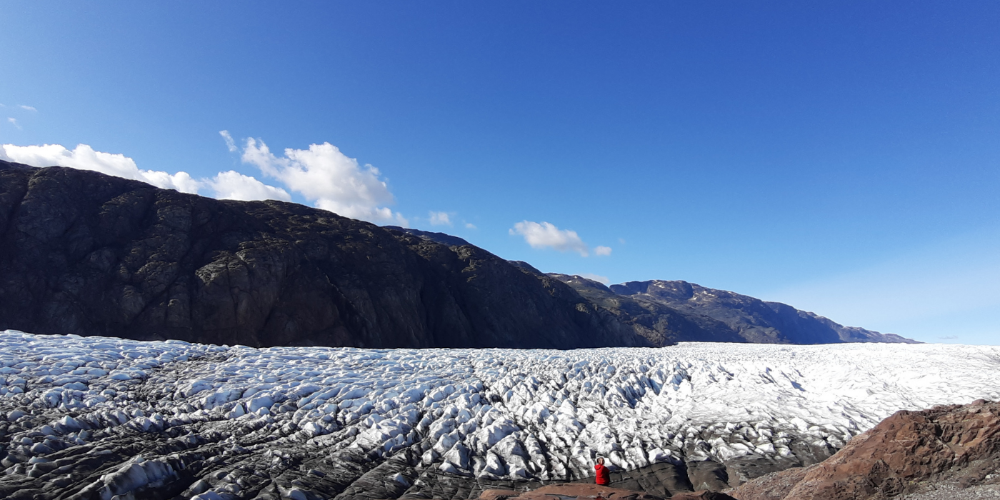
Day 5. Hike to Flower Valley and Narsarsuaq Glacier
Today, you have the entire day available to explore the spectacular landscapes surrounding Narsarsuaq.
Today's highlights:
- Hike through the beautiful Flower Valley on your way towards Narsarsuaq Glacier.
- Climb to a plateau offering magnificent views of the glacier and the Greenland Ice Sheet.
- Continue to the glacier itself, where you can experience and touch the ice up close.
- Enjoy some of the best hiking opportunities in South Greenland, with several alternative routes available around Narsarsuaq.
_(2).jpg)
Narsarsuaq Glacier - Blue Route (16 km)
The hike to the ice cap (Narsarsuaq Glacier) is a classic walk from Narsarsuaq. On this day trip you can reach the glacier and touch the ice! Furthermore, it is a trip that will offer you several different types of landscapes. This hikes takes 5-7 hours. The path is easy, but with a steep ascent and descent.
Read more about this hike here.
_(2)_(3)_(4).png)
Included hotel (Day 5)
Narsarsuaq Hostel
The hostel is nestled at the foot of a mountain with a view of the fjord. In the summertime there is always a pleasant atmosphere, with hikers and travellers exchanging experiences and planning tours.
.png)
Day 6. Qassiarsuk to Tasiusaq Sheep Farm
Today, you travel by boat from Narsarsuaq to Qassiarsuk before beginning your hike towards Tasiusaq.
Today's highlights:
- Arrive in Qassiarsuk, the area once known as Brattahlid, where Erik the Red established his settlement in AD 982.
- Follow an easy hiking route along a gravel road through the open landscapes of South Greenland.
- Enjoy beautiful views of rolling terrain dotted with small blue lakes and surrounding mountains.
- Keep an eye on the sky for white-tailed eagles soaring above the valley.
- Arrive at Tasiusaq sheep farm, beautifully located on the shores of the Sermilik Fjord.
.jpg)
Included Accommodation (Day 6)
Sermilik Hostel – Tasiusaq
Farm accommodation in Tasiusaq. The amount of icebergs here are stunning and you begin to understand why the farmers love this place.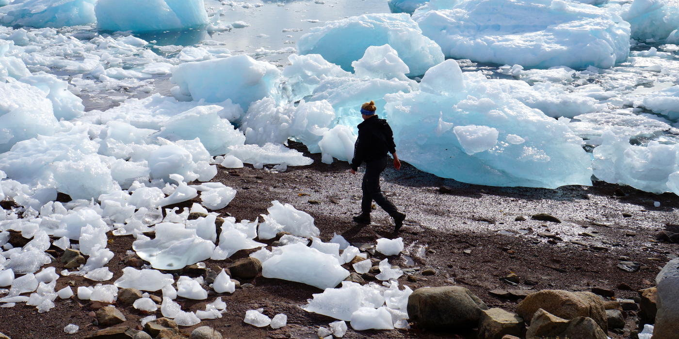
Day 7. Tasiusaq – Hike to the Ipiutaat Viewpoint
Today, you have the opportunity to explore the spectacular landscapes surrounding Tasiusaq on foot.
Today's highlights:
- Hike along the iceberg-filled shores of Sermilik Fjord towards the Ipiutaat viewpoint.
- Follow an easy walking route through open grazing land, where sheep keep the vegetation low and the views wide open.
- Cross small rivers and creeks, which in late summer are often filled with trout swimming upstream.
- Enjoy panoramic views of a large glacier stretching up to the awe-inspiring ice cap on the opposite side of Sermilik Fjord.
The hike to the Ipiutaat viewpoint is approximately 22 km return.
_(2).jpg)
Included Accommodation (Day 7)
Sermilik Hostel – Tasiusaq
Farm accommodation in Tasiusaq. The amount of icebergs here are stunning and you begin to understand why the farmers love this place..png)
Day 8. Hike from Tasiusaq to Sillisit Along the Sheep Track (15 km)
Today’s hike takes you from Tasiusaq to Sillisit, a long and varied day covering approximately 15 km.
Today’s highlights:
- From Tasiusaq, you begin by following a sheep track along the innermost part of the fjord for the first 3 kilometres. At Nunataaq, you join the gravel road towards Qassiarsuk, before leaving it again after about 1 km to continue across slightly undulating terrain towards Sillisit.
- This section of the route is a true “alone in the wild” experience in South Greenland, and you navigate by following small stone cairns built by farmers and fellow hikers.
- Sillisit is beautifully located opposite the Qooroq Ice Fjord. Here, you find today's farm stay in idyllic settings.
Today’s hike is approximately 15 km. In case of bad weather, it is recommended to stay on the gravel road all the way, passing by the Inneruulalik sheep farm, before reaching Sillisit. This is somewhat longer, approximately 23 km.
.jpg)
Included Accommodation (Day 8)
Sillisit farm
Farm accommodation in Sillisit. The farm offers an idyllic setting where a stunning wilderness backdrop meets the warm hospitality of a Greenlandic farm family—an unforgettable experience.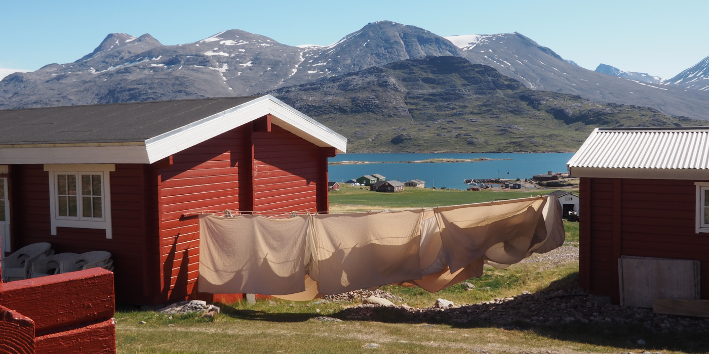
Day 9. Arrive in the village of Igaliku
Today, you travel from Sillisit to the beautiful village of Igaliku.
Today's highlights:
- Enjoy a short boat transfer from Sillisit to Itilleq, passing through the scenic waters of South Greenland.
- Follow a 4 km hike along a picturesque unpaved country road towards Igaliku.
- Arrive in Igaliku, one of the most beautiful villages in Greenland, surrounded by green grasslands and a milky-blue fjord.
- Take in the views of Illerfissalik (Burfjeld), the dramatic mountain rising on the opposite side of the fjord.
Included Hotel (Day 9)
Igaliku Bygdehotel
In the heart of the historic settlement of Igaliku, you will find Igaliku Bygdehotel, where Greenlandic hospitality meets scenic surroundings. The hotel is surrounded by lush valleys and fjords, making it an ideal base for exploring the area’s Viking history, impressive hiking trails, and relaxing atmosphere.
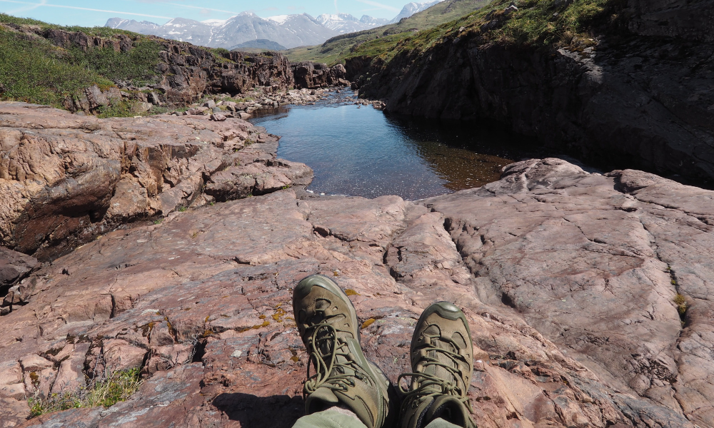
Day 10-11. Spot Qooroq Ice Fjord from the Plateau or Hike to Waterfalls
These day are dedicated to exploring Igaliku and its surrounding landscapes at your own pace.
Igaliku, known in the Norse era as Gardar, was the episcopal seat for around 300 years between 1100 and 1400. The impressive ruins from this period can still be seen today, offering a unique glimpse into Greenland’s Viking history. In 1782, Anders Olsen and his Greenlandic wife Tuperna settled here as farmers, marking the beginning of the village’s more recent history.
Today, Igaliku is surrounded by some of the finest hiking terrain in South Greenland. Check all the different hiking trails in Igaliku here.
Meals: Breakfast
You may choose between several selfguided day hikes:
_(2).png)
The Plateau Hike (17 km)
Hike to a spectacular viewpoint overlooking the Qooroq Ice Fjord, where stranded icebergs and a vast glacier create one of South Greenland's most impressive panoramas. On the way back, keep an eye out for minerals and stones, including the shimmering "moon stone" (labradorite).
_(2).png)
The Waterfall Hike (15 km)
Follow a scenic trail to a series of beautiful waterfalls cascading towards Tunulliarfik Fjord. This is one of the most popular hikes in the area. Along the way, you’ll enjoy fantastic views of the blue fjord, often with icebergs drifting by.
Nuuluk Mountain Summit (823 m)
For experienced hikers, the ascent of Nuuluk Mountain offers sweeping views of fjords, mountains and farmland. The summit can be combined with the Waterfall Hike, creating a challenging day hike of 20–22 km.
_(2).png)
Included Hotel (Day 10+11)
Igaliku Bygdehotel
In the heart of the historic settlement of Igaliku, you will find Igaliku Bygdehotel, where Greenlandic hospitality meets scenic surroundings. The hotel is surrounded by lush valleys and fjords, making it an ideal base for exploring the area’s Viking history, impressive hiking trails, and relaxing atmosphere.
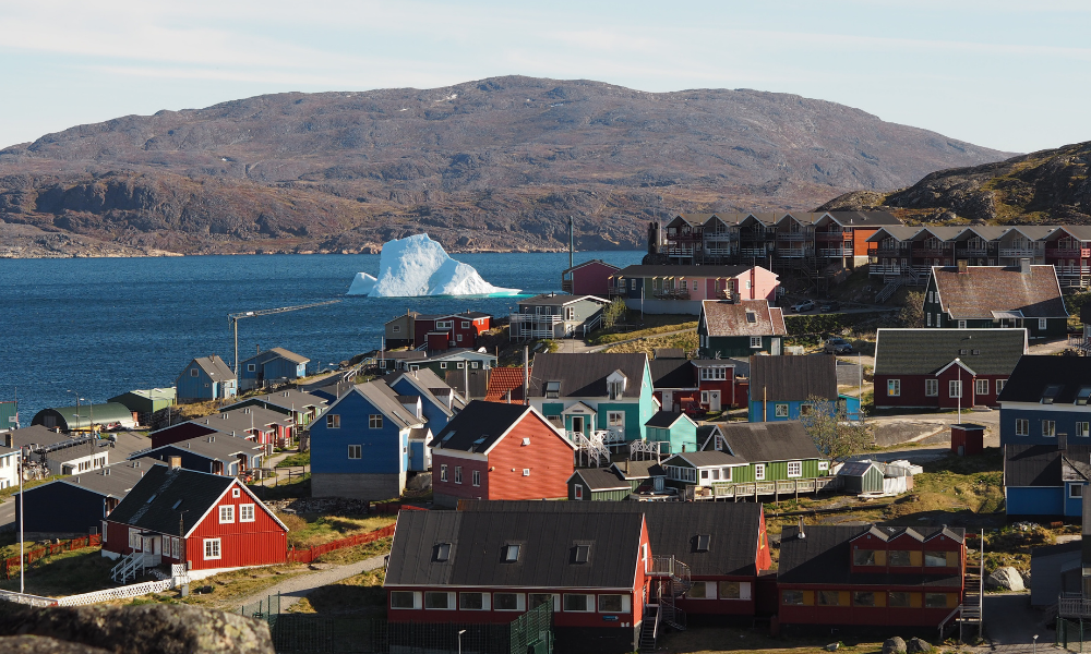
Day 12. Explore Qaqortoq at Your Own Pace
Today is yours to discover Qaqortoq and its surroundings. With colourful houses, a lively harbour, and a thriving local community, Qaqortoq is the cultural and commercial centre of South Greenland.
Today's highlights:
-
Discover the famous Stone & Man project, which consists of more than 30 sculptures that are carved into the granite bedrock by various artists. This permanent exhibition makes a stroll around the city a very special experience.
-
Visit the town square and Greenland's oldest fountain, located next to the harbour. Here you can sit and watch the hunters and fishermen selling the catch of the day at the nearby fish market.
-
Explore the charming streets of Qaqortoq and experience everyday life in South Greenland's largest town.
There is also the option to join an excursion to the historic Hvalsey Church, one of the best-preserved Norse ruins in Greenland (advance booking recommended).
Meals: Breakfast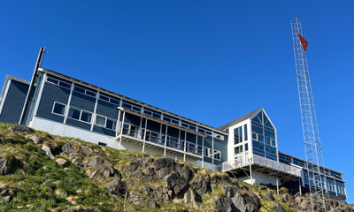
Included Hotel (Day 12)
Hotel Qaqortoq
★ ★ ★ ★
The phrase “Home – away from home” is not just a slogan but a central guiding principle for Hotel Qaqortoq and its staff. This 4-star hotel enjoys one of the town’s best locations, with views over the harbor and town center, making it a natural gathering place for both guests and locals.
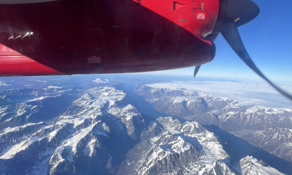
Day 13. Farewell to South Greenland
Depart from Qaqortoq Airport (JJU)
Enjoy a final glimpse of South Greenland’s fjords and colourful townscape before your journey home.
At the arranged time, you will be picked up and driven to the airport for your departure, taking with you memories of amazing hikes and life in one of the world’s most remote landscapes.
Extend Your Trip?
Do you feel the trip is too short and want to extend it? Whether it’s to another destination in Greenland or simply more time to explore, feel free to ask us. We have extensive knowledge of Greenland and can provide guidance quickly and easily.
Season and practical info
Greenland is a truly unique destination – majestic, yet not always easy to reach. That is part of its charm. Our travel advisors are happy to help you tailor a trip that matches your wishes and interests. As part of our guidance, we also advise you on the best time to plan your journey, ensuring you bring home the most memorable experiences.
About South Greenland and this itinerary
Greenland is a truly unique destination – majestic, yet not always easy to reach. That is part of its charm. Our travel advisors are happy to help you tailor a trip that matches your wishes and interests. As part of our guidance, we also advise you on the best time to plan your journey, ensuring you bring home the most memorable experiences.
When is the best time to travel?
You can start this tour every day of the week and are free to choose your own pace and what to see and do each day. Just let us know which date/flight you will arrive with and we will book the tour for you as desired.
The best time to travel for this itinerary in South Greenland is from June to September.
Difficulty
Hikes between the hostels are over easy/moderate terrain or follow gravel roads. Some hikes are long 15-23 km depending on the route. Please note, that you have to carry your own luggage on this backpacker tour!
Self-guided
All our package tours are self-guided. This means that you are not a part of a bigger group with a tour leader to guide you around. We will send you very detailed information about the tour before you arrive in Greenland.
Accommodation and meals
Sleeping bag accommodation at farm and hostel in 4-bed and 6-bed dorm rooms. Bring your own sleeping bag.
The tour includes an upgrade with 3 nights at Igaliku country hotel and 3 nights at Narsaq Guest house with bed linens, towels and breakfast.
Meals
No meals included at farms and hostels.Breakfast included at Igaliku country hotel and Narsaq Guest house.
Cooking facilities available at all sheep farms and in Narsarsuaq so you can prepare your own meals. You can also choose to prebook dinner at some/all sheep farms. A nice way to meet the local family at the farm. All dinners have to be ordered in advance and paid directly to the farmer on site. Prices are around 350 DKK/meal.
You can go shopping in Narsarsuaq, Qassiarsuk, Igaliku and Narsaq.
There are restaurants in Narsaq and Igaliku.
How to get here
There are direct flights to Qaqortoq (South Greenland) from Nuuk (GOH) all year round and from Iceland (Reykjavik, KEF) in the high season from mid-June to early September.
Tickets can be purchased at the airlines’ websites:
- Air Greenland flies from Nuuk to Qaqortoq.
- Icelandair flies from Reykjavik to Qaqortoq. Iceland air provides connecting flights from many major cities in US and EU. With just one stopover in Reykjavik.
Several airlines fly from Europe and the US to Denmark and Iceland.
Please notice, flight tickets are not included in any of our tours or products.
Food and drink
Meat and fish are the foundation of the Greenlandic diet, so be prepared for high-protein fare with relatively few vegetables and side dishes.
In South Greenland you will primarily be served lamb, but also musk ox, reindeer and whale meat. Cod, trout and shrimp are the most common fish and seafood used in South Greenlandic cuisine.
If you have an opportunity to cook your own meals, you won’t want to miss out on a visit to the local meat and fish market, where hunters and fishermen sell the catch of the day.
In South Greenland several sheep farmers have also begun to grow potatoes, turnips, lettuce and cabbage on a larger scale and you can enjoy this fresh produce if you are travelling in late summer.
Opening hours
There are grocery stores (the Pilersuisoq chain) in the villages of Narsarsuaq, Qassiarsuk and Igaliku, where you can buy canned, dried and frozen food, and to a limited extend fresh products. If your package tour includes one of the major towns, we always recommend that you buy food in a supermarket there before continuing on to a small village.
In the towns of Narsaq, Qaqortoq and Nanortalik shops are generally open from 8-9 am to 5-6 pm on weekdays, with slightly shorter opening hours on Saturdays and Sundays. In the settlements (Narsarsuaq, Qassiarsuk and Igaliku) shop opening hours are somewhat more limited: weekdays often from 10 am to 3 pm, Saturdays 10-12 am and closed on Sundays.
About dining in villages and on sheep farms
We always recommend that you take the opportunity to eat locally and taste different Greenlandic dishes when you visit a sheep farm or a small settlement. However, please do not expect a large variety of dishes (à la carte menu), as well as a special children’s menu or vegetarian dishes at such places, as shopping facilities and the choice of products are limited.
If you are a vegetarian or have a food allergy (e.g., allergic to gluten), you may want to consider bringing some food along with you, unless you will be staying in the vicinity of a supermarket in one of the major towns!
Costs
The price level of food in shops is roughly the same as in the rest of Northern Europe. Fresh fruit and vegetables, alcoholic drinks and sweets are the most expensive. See below for indicative prices for meals in cafes/restaurants:
Lunch at cafes/hotels: DKK 120-150 (approx. 16-20 EUR)
Dinner at cafeteria / sheep farm / restaurant: DKK 120 (approx. 16 EUR) / DKK 200-300 (approx. 27-40 EUR) / DKK 200-400 (approx. 27-54 EUR)
These prices are without drinks
1 beer at a bar/restaurant: from DKK 50 (approx. 7 EUR)
1 bottle of wine at a restaurant: from DKK 230 (approx. 31 EUR)
Money, Tele & Internet
Currency and Credit cards
The currency used in Greenland is the Danish krone (DKK). You can pay by credit card in stores (also in the settlements), at hotels, restaurants (including the Igaliku Country Hotel) and at tourist offices. However, it is a good idea to have a small amount of cash with you, especially if you are going to stay and dine on a sheep farm, where cash is the only means of payment. There are ATMs in the towns of Narsaq, Qaqortoq and Nanortalik.
Telephony
There is mobile coverage in all towns and villages. Most European telecommunications providers have roaming agreements with Tele Greenland, but it might be quite expensive to use your phone in Greenland. You should also not rely on your mobile phone as a means of communicating with the outside world on a hiking trip, as there are many places in the countryside/mountains where you will not have a signal. If you are planning a longer hiking or kayaking trip in isolated areas, for safety reasons we recommend that you rent a satellite phone.
Internet
There is wireless internet at most hotels and hostels in the towns (including Narsarsuaq and the Igaliku Country Hotel). At most tourist offices you can also borrow a computer to check your emails and so on. What all of these points of access have in common is that you pay for the use of the internet in Greenland and – compared to the rest of Europe – it is quite expensive.
Mobile Phone
Using mobile data from an international phone can be very expensive in Greenland. Make sure to check what your plan covers before enabling data roaming. If you need a Greenlandic SIM card, we recommend Tusass eSIM packages. See prices and packages here (affiliate link).
Access to Electricity
It is possible to charge your devices at the accommodations (bring your own charger).
IMPORTANT NOTE!
Please note that the price of the trip is a starting price, as there may be additional costs for a more expensive type of flight ticket or a different cabin/room standard, depending on availability at the time of booking. You are, of course, only committed to the trip once any price supplements have been confirmed. The starting price is indicated for Greenland’s low season.
Right to Changes Reserved. Please note that a trip like this is weather-dependent, and some changes to the program may occur. Delays and cancellations are possible, especially for flights and boat transport.
No compensation or reimbursement is provided for the first 24 hours of delays or changes due to external circumstances. We will make every effort to minimize inconvenience, provide an alternative program, or make the most of the extra waiting time.
What to bring
For our package tours in South Greenland we recommend:
- A sleeping bag and towel (only if you stay in hostels)
- Slippers or sandals (for use indoors when you stay at hostels/farms or visit a Greenlandic home)
- Hiking boots or solid walking shoes
- Wind and waterproof outerwear
- Sweater or fleece for insulation
- T-shirts and long-sleeved blouses (it can get really hot in the sun on land)
- A knit hat and gloves (it can be rather chilly on a boat trip to the ice fjord)
- A mosquito net and mosquito repellent (which can also be purchased at Blue Ice Café). The mosquitoes are worst in June and early July in southern Greenland. There may be small, annoying flies in August. Mosquitoes are virtually non-existent in sheep farming areas, but can be troublesome in Narsarsuaq and mountain areas with few or no sheep
- Sunglasses and sun lotion